

05-19-2021 Portsmouth, Hampshire, UK, Wymore Nebraska USA Shown on a Geography map or Road map
Коллекция по умолчанию
Коллекция по умолчанию
Создать новую

map of Colorado
Коллекция по умолчанию
Коллекция по умолчанию
Создать новую

Colorful Montana political map with clearly labeled, separated layers. Vector illustration.
Коллекция по умолчанию
Коллекция по умолчанию
Создать новую

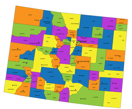
Map of Colorado
Коллекция по умолчанию
Коллекция по умолчанию
Создать новую
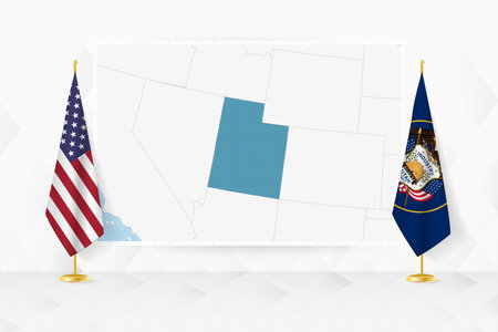
Map of Utah and flags of Utah on flag stand. Vector illustration for diplomacy meeting.
Коллекция по умолчанию
Коллекция по умолчанию
Создать новую

October 7th, 2015 - Montreal, Canada. Old 1940s Webster's Dictionary United States of America Map Close-up
Коллекция по умолчанию
Коллекция по умолчанию
Создать новую

Wyoming map shape, united states of america. Flat concept icon symbol vector illustration.
Коллекция по умолчанию
Коллекция по умолчанию
Создать новую

map of Colorado
Коллекция по умолчанию
Коллекция по умолчанию
Создать новую

map of Colorado
Коллекция по умолчанию
Коллекция по умолчанию
Создать новую

wyoming administrative map
Коллекция по умолчанию
Коллекция по умолчанию
Создать новую

Panoramic view of sacred Native American lands during autumns change
Коллекция по умолчанию
Коллекция по умолчанию
Создать новую

map of Colorado
Коллекция по умолчанию
Коллекция по умолчанию
Создать новую

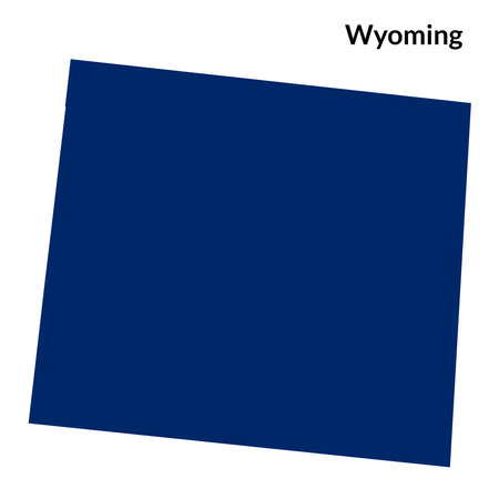
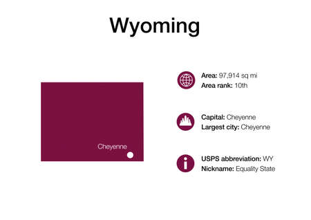
Map of Wyoming
Коллекция по умолчанию
Коллекция по умолчанию
Создать новую

Black map of the State of Utah - vector illustration. Simple flat map State of Utah.
Коллекция по умолчанию
Коллекция по умолчанию
Создать новую

Wyoming state map with flag. vector illustration.
Коллекция по умолчанию
Коллекция по умолчанию
Создать новую

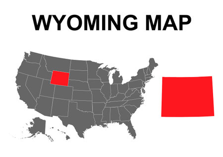
United States of America isolated map and Wyoming State territory. USA political map. geographic design
Коллекция по умолчанию
Коллекция по умолчанию
Создать новую

Wyoming counties map outlines blank
Коллекция по умолчанию
Коллекция по умолчанию
Создать новую

A Map of the the United States of America with 1 state selected - Wyoming
Коллекция по умолчанию
Коллекция по умолчанию
Создать новую

05-18-2021 Portsmouth, Hampshire, UK, Troy Missouri USA shown on a Geography map or road map
Коллекция по умолчанию
Коллекция по умолчанию
Создать новую

Wyoming state detailed editable map with cities and towns, geographic sites, roads, railways, interstates and U.S. highways.
Коллекция по умолчанию
Коллекция по умолчанию
Создать новую

Pine Bluffs, Wyoming, United States - August 15, 2018: Shot of a Welcome Wyoming sign along the interstate I-80 in Pine Bluffs, WY.
Коллекция по умолчанию
Коллекция по умолчанию
Создать новую
Colorful Colorado political map with clearly labeled, separated layers. Vector illustration.
Коллекция по умолчанию
Коллекция по умолчанию
Создать новую

Old vintage map mounted on a wall showing the State of Minnesota.
Коллекция по умолчанию
Коллекция по умолчанию
Создать новую
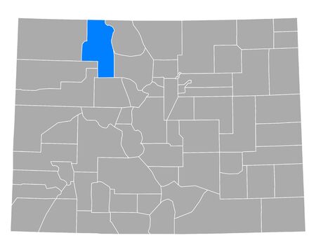
Map of Routt in Colorado
Коллекция по умолчанию
Коллекция по умолчанию
Создать новую
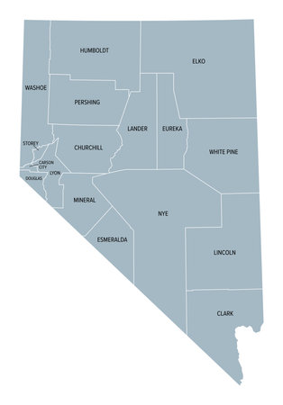
Nevada state counties, gray political map. Landlocked state in the Western region of the United States, subdivided into 16 counties and independent Carson City.
Коллекция по умолчанию
Коллекция по умолчанию
Создать новую

Montana, U.S. state, multi colored political map with borders, county names and Capital Helena. State in the Mountain West region of the United States, subdivided into 56 counties.
Коллекция по умолчанию
Коллекция по умолчанию
Создать новую

Close up shot of the Japanese map.
Коллекция по умолчанию
Коллекция по умолчанию
Создать новую
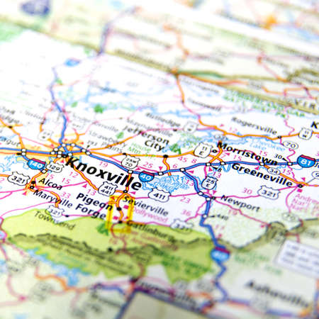
Close-Up map of Knoxville, Tennesse
Коллекция по умолчанию
Коллекция по умолчанию
Создать новую

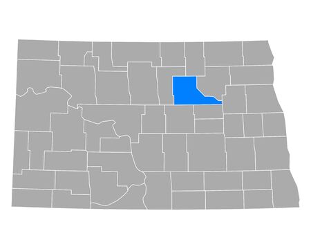
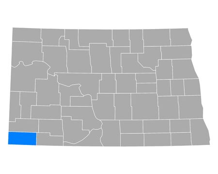
Map of North Dakota
Коллекция по умолчанию
Коллекция по умолчанию
Создать новую

Red clerical needle on a map of USA, Utah and the capital Salt Lake City. Closeup Map Utah with Red Tack, US map pin
Коллекция по умолчанию
Коллекция по умолчанию
Создать новую

Las Vegas, Nevada is the center of focus on an old map.
Коллекция по умолчанию
Коллекция по умолчанию
Создать новую

Black highlighted location map of the Crook County inside gray administrative map of the Federal State of Wyoming, USA
Коллекция по умолчанию
Коллекция по умолчанию
Создать новую

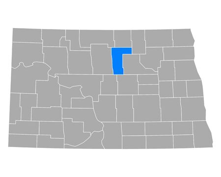
Map of Walsh in North Dakota
Коллекция по умолчанию
Коллекция по умолчанию
Создать новую
Wyoming state with USA map
Коллекция по умолчанию
Коллекция по умолчанию
Создать новую

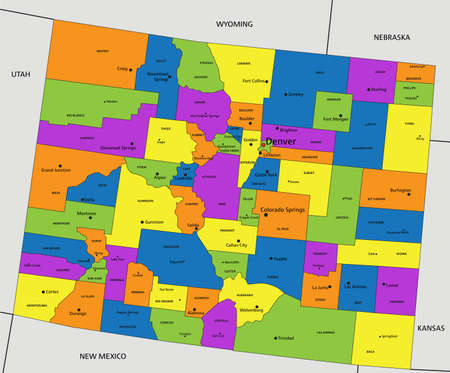
Colorado, U.S. state, subdivided into 64 counties, multi colored political map with capital Denver, borders and county names. State in the Mountain West region of Western USA.
Коллекция по умолчанию
Коллекция по умолчанию
Создать новую

Realistic 3D Flag of Wyoming with fabric texture waving
Коллекция по умолчанию
Коллекция по умолчанию
Создать новую

Map of Utah
Коллекция по умолчанию
Коллекция по умолчанию
Создать новую

Map of Goshen in Wyoming
Коллекция по умолчанию
Коллекция по умолчанию
Создать новую

Erosion of nature makes beautiful canyon landscape, Dead horse state park, Utah USA
Коллекция по умолчанию
Коллекция по умолчанию
Создать новую

a large land plain on an empty desert, featuring a naturalistic landscape background in the style of native american, first nations, and alaska native art. this national geographic photo captures the mountainous vistas with light brown and orange hues. taken with a nikon d750, the image showcases the artistic vision of maya lin. ai generated
Коллекция по умолчанию
Коллекция по умолчанию
Создать новую

05-17-2021 Portsmouth, Hampshire, UK, Cannon Falls Minnesota USA shown on a Geography map or road map
Коллекция по умолчанию
Коллекция по умолчанию
Создать новую

Коллекция по умолчанию
Коллекция по умолчанию
Создать новую
Montana, U.S. state, subdivided into 56 counties, gray political map with borders and county names. State in the Mountain West region of United States, nicknamed Big Sky Country.
Коллекция по умолчанию
Коллекция по умолчанию
Создать новую

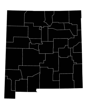
Highly detailed editable political map with separated layers. New Mexico.
Коллекция по умолчанию
Коллекция по умолчанию
Создать новую

Black map of the State of North Dakota - vector illustration. Simple flat map State of North Dakota.
Коллекция по умолчанию
Коллекция по умолчанию
Создать новую

Map of South Dakota
Коллекция по умолчанию
Коллекция по умолчанию
Создать новую

05-19-2021 Portsmouth, Hampshire, UK, Bruning Nebraska USA Shown on a Geography map or Road map
Коллекция по умолчанию
Коллекция по умолчанию
Создать новую

Macro of Poland on a globe, narrow depth of field
Коллекция по умолчанию
Коллекция по умолчанию
Создать новую

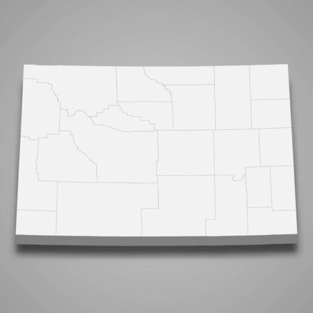
Wyoming map
Коллекция по умолчанию
Коллекция по умолчанию
Создать новую

04-30-2021 Portsmouth, Hampshire, UK, Belle Glade Florida USA Shown on a geography map or road map
Коллекция по умолчанию
Коллекция по умолчанию
Создать новую

Large and detailed map and info about Marion County in Alabama
Коллекция по умолчанию
Коллекция по умолчанию
Создать новую
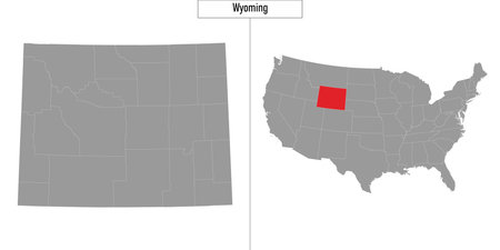
Simple map of Wyoming state of United States and location on USA map
Коллекция по умолчанию
Коллекция по умолчанию
Создать новую
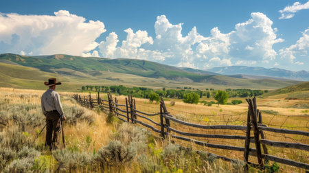
Cowboy Standing by Wooden Fence Overlooking Open Field in Mountain Valley
Коллекция по умолчанию
Коллекция по умолчанию
Создать новую

Map of Billings in North Dakota
Коллекция по умолчанию
Коллекция по умолчанию
Создать новую

Governor of California flag textile cloth fabric waving on the top sunrise mist fog
Коллекция по умолчанию
Коллекция по умолчанию
Создать новую

South Dakota, U.S. state, subdivided into 66 counties, multi colored political map with capital Pierre, borders and county names. North Central region of United States.
Коллекция по умолчанию
Коллекция по умолчанию
Создать новую

Americas map, Americas location , United States of America map
Коллекция по умолчанию
Коллекция по умолчанию
Создать новую
Colorful Colorado political map with clearly labeled, separated layers. Vector illustration.
Коллекция по умолчанию
Коллекция по умолчанию
Создать новую
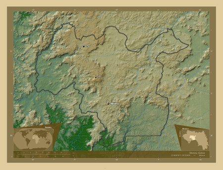
Mamou, region of Guinea. Colored elevation map with lakes and rivers. Locations and names of major cities of the region. Corner auxiliary location maps
Коллекция по умолчанию
Коллекция по умолчанию
Создать новую

05-04-2021 Portsmouth, Hampshire, UK, Wayne City Illinois Shown on a Geography map or road map
Коллекция по умолчанию
Коллекция по умолчанию
Создать новую

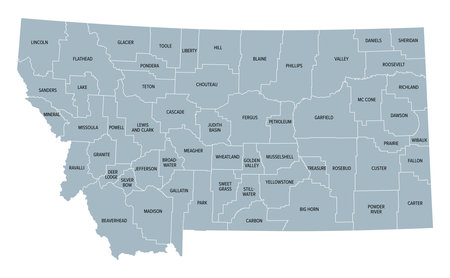
The Montana State county map with labels
Коллекция по умолчанию
Коллекция по умолчанию
Создать новую

Map of Campbell in Wyoming
Коллекция по умолчанию
Коллекция по умолчанию
Создать новую

Montana, state of United States of America. High resolution satellite maps
Коллекция по умолчанию
Коллекция по умолчанию
Создать новую

Rocky mountain peaks near Helena, Montana, USA.
Коллекция по умолчанию
Коллекция по умолчанию
Создать новую
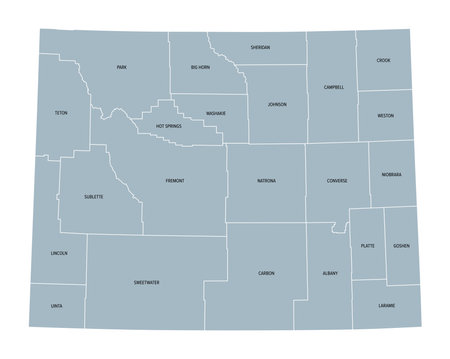
Map of Wyoming state with political demographic information and biggest cities
Коллекция по умолчанию
Коллекция по умолчанию
Создать новую

Black highlighted location map of the Laramie County inside gray administrative map of the Federal State of Wyoming, USA
Коллекция по умолчанию
Коллекция по умолчанию
Создать новую
3d map of is a state of United States
Коллекция по умолчанию
Коллекция по умолчанию
Создать новую

Horses among the mountains and valleys in Sunlight Basin.
Коллекция по умолчанию
Коллекция по умолчанию
Создать новую

Red clerical needle on a map of the USA, Arizona and the capital Phoenix. Close up map of orizona with red tack, US map pin
Коллекция по умолчанию
Коллекция по умолчанию
Создать новую
Wyoming, U.S. state, subdivided into 23 counties, gray political map with county names. State in the Mountain West region of the United States, nicknamed Equality and Cowboy State.
Коллекция по умолчанию
Коллекция по умолчанию
Создать новую
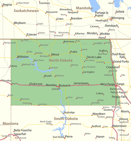
Map of North Dakota. Shows state borders, urban areas, place names, roads and highways.
Projection: Mercator.
Коллекция по умолчанию
Коллекция по умолчанию
Создать новую

05-04-2021 Portsmouth, Hampshire, UK, Wanatah Indiana USA shown on a geography map or road map
Коллекция по умолчанию
Коллекция по умолчанию
Создать новую

Map of Prowers in Colorado
Коллекция по умолчанию
Коллекция по умолчанию
Создать новую

Map of Wyoming
Коллекция по умолчанию
Коллекция по умолчанию
Создать новую
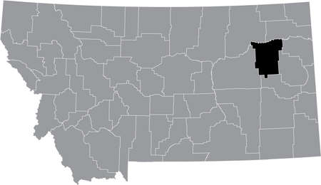
Black highlighted location map of the McCone County inside gray map of the Federal State of Montana, USA
Коллекция по умолчанию
Коллекция по умолчанию
Создать новую
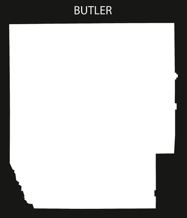
Butler county map of Alabama USA black inverted illustration
Коллекция по умолчанию
Коллекция по умолчанию
Создать новую
Map of Pierce in North Dakota
Коллекция по умолчанию
Коллекция по умолчанию
Создать новую

Black highlighted location map of the Allen County inside gray map of the Federal State of Kansas, USA
Коллекция по умолчанию
Коллекция по умолчанию
Создать новую

Black highlighted location map of the Greeley County inside gray map of the Federal State of Kansas, USA
Коллекция по умолчанию
Коллекция по умолчанию
Создать новую

Map of Stevens in Kansas
Коллекция по умолчанию
Коллекция по умолчанию
Создать новую

U.S. states - map of Oklahoma. Hand made. Rivers and lakes are shown. Please look at my other images of cartographic series - they are all very detailed and carefully drawn by hand WITH RIVERS AND LAKES.
Коллекция по умолчанию
Коллекция по умолчанию
Создать новую
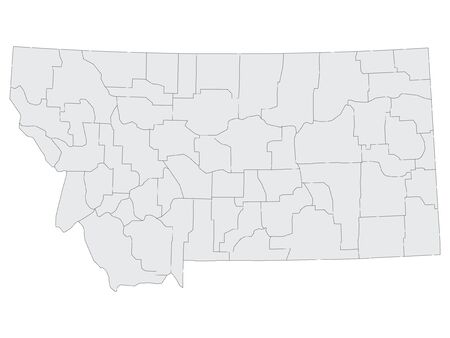
Gray Map on White Background of Counties of USA Federal State of Montana
Коллекция по умолчанию
Коллекция по умолчанию
Создать новую
Wyoming map shape, united states of america. Flat concept icon symbol vector illustration.
Коллекция по умолчанию
Коллекция по умолчанию
Создать новую

map of South Dakota
Коллекция по умолчанию
Коллекция по умолчанию
Создать новую

Oklahoma map. Poster with map of the us state in retro color palette. Shape of Oklahoma with sunburst rays background. Vector illustration.
Коллекция по умолчанию
Коллекция по умолчанию
Создать новую

US state Wyoming map highlighted in Wyoming flag colors, gray map with neighboring usa states.
Коллекция по умолчанию
Коллекция по умолчанию
Создать новую

Three-dimensional map of North Dakota. USA. 3d
Коллекция по умолчанию
Коллекция по умолчанию
Создать новую
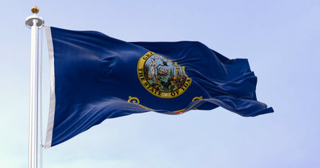
Idaho state flag fluttering in the wind. Blue background with the state seal and a red band with State of Idaho in gold text. 3d illustration render. Selective focus. Close-up
Коллекция по умолчанию
Коллекция по умолчанию
Создать новую

Map of Carbon in Wyoming
Коллекция по умолчанию
Коллекция по умолчанию
Создать новую

New Mexico, state of United States of America. High resolution satellite maps
Коллекция по умолчанию
Коллекция по умолчанию
Создать новую
Map of New Mexico
Коллекция по умолчанию
Коллекция по умолчанию
Создать новую

Map of the United States with Nevada highlight
Коллекция по умолчанию
Коллекция по умолчанию
Создать новую

Counties map of Kansas USA
Коллекция по умолчанию
Коллекция по умолчанию
Создать новую

Outstanding Agathla Peak from surrounding terrain on the sideways with electric pole along the highway of the U.S. route 163 from south to north with white cloud and blue sky on sunshine day, this road leading to Monument Valley in Arizona.
Коллекция по умолчанию
Коллекция по умолчанию
Создать новую
Map of Benson in North Dakota
Коллекция по умолчанию
Коллекция по умолчанию
Создать новую

Map of Johnson in Wyoming
Коллекция по умолчанию
Коллекция по умолчанию
Создать новую

Map of Weld in Colorado
Коллекция по умолчанию
Коллекция по умолчанию
Создать новую

Nebraska winter snowflakes flag background. United States of America. 3d illustration
Коллекция по умолчанию
Коллекция по умолчанию
Создать новую
Map of Bowman in North Dakota
Коллекция по умолчанию
Коллекция по умолчанию
Создать новую

GRAY CMYK color detailed flat map of the federal state of MONTANA, UNITED STATES OF AMERICA on transparent background
Коллекция по умолчанию
Коллекция по умолчанию
Создать новую
Legion-Media
Создайте свои проекты на основе качественных стоковых фотографий и видео.


Copyright © Legion-Media.