
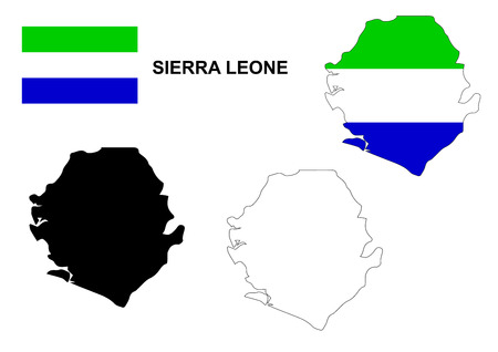
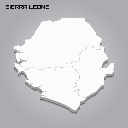
Sierra Leone map and flag
Коллекция по умолчанию
Коллекция по умолчанию
Создать новую

Lesotho.
Коллекция по умолчанию
Коллекция по умолчанию
Создать новую

Sunrise above Uruguay highlighted in red on model of planet Earth in space with visible country borders. 3D illustration.
Коллекция по умолчанию
Коллекция по умолчанию
Создать новую

Tasmania, state of Australia. Elevation map colored in wiki style with lakes and rivers
Коллекция по умолчанию
Коллекция по умолчанию
Создать новую

Zamboanga del Norte, province of Philippines. Colored elevation map with lakes and rivers
Коллекция по умолчанию
Коллекция по умолчанию
Создать новую

Istarska, county of Croatia. Elevation map colored in sepia tones with lakes and rivers
Коллекция по умолчанию
Коллекция по умолчанию
Создать новую

Kaohsiung, special municipality of Taiwan. Colored elevation map with lakes and rivers
Коллекция по умолчанию
Коллекция по умолчанию
Создать новую

Gabon area enlarged and glowed on a darkened background of its surroundings. Satellite imagery
Коллекция по умолчанию
Коллекция по умолчанию
Создать новую

Negros Oriental, province of Philippines. Low resolution satellite maps
Коллекция по умолчанию
Коллекция по умолчанию
Создать новую

Area of Benin isolated on a solid background in a georeferenced bounding box. Main regional division, distance scale, labels. Topographic relief map. 3D rendering
Коллекция по умолчанию
Коллекция по умолчанию
Создать новую

Misamis Oriental, province of Philippines. Low resolution satellite maps
Коллекция по умолчанию
Коллекция по умолчанию
Создать новую

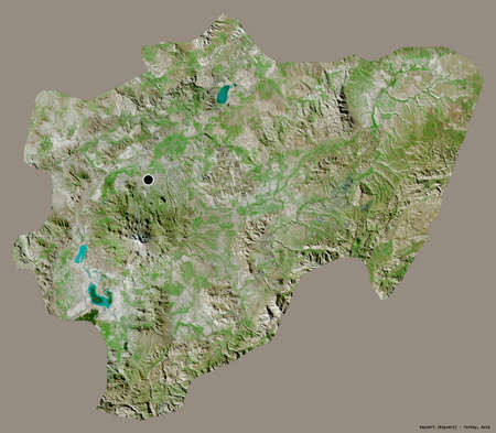
Hentiy, province of Mongolia. Sentinel-2 satellite imagery. Shape isolated on black. Description, location of the capital. Contains modified Copernicus Sentinel data
Коллекция по умолчанию
Коллекция по умолчанию
Создать новую

Sonora, state of Mexico. Sentinel-2 satellite imagery. Shape isolated on black. Description, location of the capital. Contains modified Copernicus Sentinel data
Коллекция по умолчанию
Коллекция по умолчанию
Создать новую
Occidental Mindoro, province of Philippines. Elevation map colored in wiki style with lakes and rivers
Коллекция по умолчанию
Коллекция по умолчанию
Создать новую
A Map of the country of Sierra Leone
Коллекция по умолчанию
Коллекция по умолчанию
Создать новую

Misamis Oriental, province of Philippines. Colored elevation map with lakes and rivers
Коллекция по умолчанию
Коллекция по умолчанию
Создать новую

Primorye, territory of Russia. Low resolution satellite maps
Коллекция по умолчанию
Коллекция по умолчанию
Создать новую

Jijel, province of Algeria. High resolution satellite maps
Коллекция по умолчанию
Коллекция по умолчанию
Создать новую

Somalia from space on model of planet Earth with networks. Detailed planet surface with city lights. 3D illustration.
Коллекция по умолчанию
Коллекция по умолчанию
Создать новую
Ninh Thuan, province of Vietnam. Elevation map colored in wiki style with lakes and rivers
Коллекция по умолчанию
Коллекция по умолчанию
Создать новую

Sunset above Mozambique from space on planet Earth with visible country borders. 3D illustration.
Коллекция по умолчанию
Коллекция по умолчанию
Создать новую

big size black map of senegal with flag
Коллекция по умолчанию
Коллекция по умолчанию
Создать новую
Sierra Leone 3d map with borders of regions. Vector illustration
Коллекция по умолчанию
Коллекция по умолчанию
Создать новую

Shape of Liberia with its capital isolated on a solid color background. Satellite imagery. 3D rendering
Коллекция по умолчанию
Коллекция по умолчанию
Создать новую

Shape of Kotayk, province of Armenia, with its capital isolated on a solid color background. Satellite imagery. 3D rendering
Коллекция по умолчанию
Коллекция по умолчанию
Создать новую

Congo from space on Earth at night. Very fine detail of the plastic planet surface with bright city lights. 3D illustration.
Коллекция по умолчанию
Коллекция по умолчанию
Создать новую

Albania. Shaded relief map with major urban areas. Surrounding territory greyed out. Colored according to vegetation. Includes clip path for the state area.
Projection: Stanfard Mercator
Extents: 18.5/21.6/39.0/43.2
Data source: NASA
Коллекция по умолчанию
Коллекция по умолчанию
Создать новую

Sicily, autonomous region of Italy. Grayscale elevation map with lakes and rivers
Коллекция по умолчанию
Коллекция по умолчанию
Создать новую

Madagascar on model of green planet Earth with international networks. Concept of digital communication and technology. 3D illustration.
Коллекция по умолчанию
Коллекция по умолчанию
Создать новую

L'Artibonite, department of Haiti. Low resolution satellite maps
Коллекция по умолчанию
Коллекция по умолчанию
Создать новую
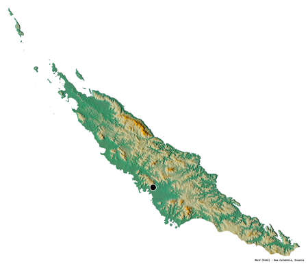
Shape of Nord, province of New Caledonia, with its capital isolated on white background. Topographic relief map. 3D rendering
Коллекция по умолчанию
Коллекция по умолчанию
Создать новую
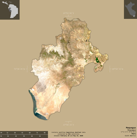
Moquegua, region of Peru. Sentinel-2 satellite imagery. Shape isolated on solid background with informative overlays. Contains modified Copernicus Sentinel data
Коллекция по умолчанию
Коллекция по умолчанию
Создать новую

Botswana Map Shaded relief Color Height map on the sea Blue Background 3d illustration
Коллекция по умолчанию
Коллекция по умолчанию
Создать новую

Shape of Isiolo, county of Kenya, with its capital isolated on a solid color background. Satellite imagery. 3D rendering
Коллекция по умолчанию
Коллекция по умолчанию
Создать новую
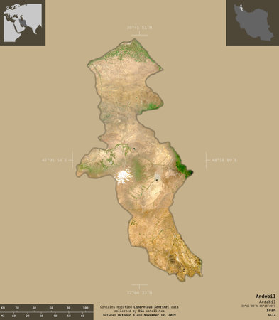
Ardebil, province of Iran. Sentinel-2 satellite imagery. Shape isolated on solid background with informative overlays. Contains modified Copernicus Sentinel data
Коллекция по умолчанию
Коллекция по умолчанию
Создать новую

South Sudan in early morning light highlighted in red on planet Earth. 3D illustration.
Коллекция по умолчанию
Коллекция по умолчанию
Создать новую

Callao, province of Peru. Elevation map colored in sepia tones with lakes and rivers
Коллекция по умолчанию
Коллекция по умолчанию
Создать новую
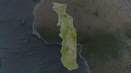
Togo area enlarged and glowed on a darkened background of its surroundings. Satellite imagery
Коллекция по умолчанию
Коллекция по умолчанию
Создать новую

Three-dimensional map of South Carolina. USA. 3d
Коллекция по умолчанию
Коллекция по умолчанию
Создать новую

Madagascar on model of green planet Earth with international networks. Concept of digital communication and technology. 3D illustration.
Коллекция по умолчанию
Коллекция по умолчанию
Создать новую

Shape of Kindia, region of Guinea, with its capital isolated on a solid color background. Satellite imagery. 3D rendering
Коллекция по умолчанию
Коллекция по умолчанию
Создать новую

Benin in red at night as seen from Earth's orbit in space. 3D illustration with highly detailed realistic planet surface. Elements of this image furnished by NASA.
Коллекция по умолчанию
Коллекция по умолчанию
Создать новую

Africa with highlighted Lesotho map. Vector Illustration.
Коллекция по умолчанию
Коллекция по умолчанию
Создать новую

Burundi highlighted in red on model of planet Earth with very detailed land surface and visible city lights. 3D illustration. Elements of this image furnished by NASA.
Коллекция по умолчанию
Коллекция по умолчанию
Создать новую
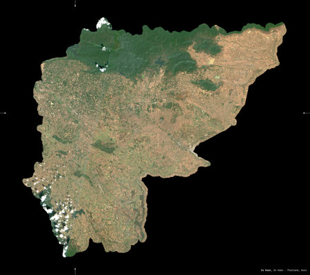
Sa Kaeo, province of Thailand. Sentinel-2 satellite imagery. Shape isolated on black. Description, location of the capital. Contains modified Copernicus Sentinel data
Коллекция по умолчанию
Коллекция по умолчанию
Создать новую

Mozambique with embedded national flag at night from space. 3D illustration with detailed planet surface and visible city lights.
Коллекция по умолчанию
Коллекция по умолчанию
Создать новую

Paraguay at night from space with visible country borders. 3D illustration.
Коллекция по умолчанию
Коллекция по умолчанию
Создать новую

Compostela Valley, province of Philippines. Elevation map colored in wiki style with lakes and rivers
Коллекция по умолчанию
Коллекция по умолчанию
Создать новую
Kaohsiung, special municipality of Taiwan. Elevation map colored in wiki style with lakes and rivers
Коллекция по умолчанию
Коллекция по умолчанию
Создать новую

Ethiopia in early morning light highlighted in red on planet Earth. 3D illustration.
Коллекция по умолчанию
Коллекция по умолчанию
Создать новую

Jawa Barat, province of Indonesia. High resolution satellite maps
Коллекция по умолчанию
Коллекция по умолчанию
Создать новую

Skane, county of Sweden. Elevation map colored in wiki style with lakes and rivers
Коллекция по умолчанию
Коллекция по умолчанию
Создать новую

3d Deep Blue Water Malawi Map Shaded Relief Texture Map On White Background 3d Illustration
Коллекция по умолчанию
Коллекция по умолчанию
Создать новую
Morelos, state of Mexico. Sentinel-2 satellite imagery. Shape isolated on black. Description, location of the capital. Contains modified Copernicus Sentinel data
Коллекция по умолчанию
Коллекция по умолчанию
Создать новую

Shape of South Korea with its capital isolated on white background. Satellite imagery. 3D rendering
Коллекция по умолчанию
Коллекция по умолчанию
Создать новую

Northland, regional council of New Zealand. Elevation map colored in wiki style with lakes and rivers
Коллекция по умолчанию
Коллекция по умолчанию
Создать новую
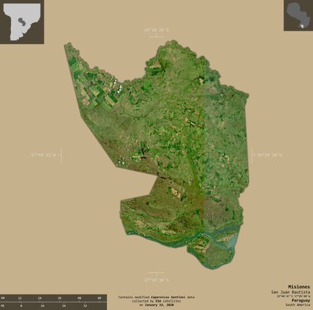
Misiones, department of Paraguay. Sentinel-2 satellite imagery. Shape isolated on solid background with informative overlays. Contains modified Copernicus Sentinel data
Коллекция по умолчанию
Коллекция по умолчанию
Создать новую

Burkina Faso area enlarged and glowed on a darkened background of its surroundings. Satellite imagery
Коллекция по умолчанию
Коллекция по умолчанию
Создать новую

Ceara, state of Brazil. Colored elevation map with lakes and rivers
Коллекция по умолчанию
Коллекция по умолчанию
Создать новую

Political map Nigeria with national flag symbol embedded into the country. 3D illustration
Коллекция по умолчанию
Коллекция по умолчанию
Создать новую
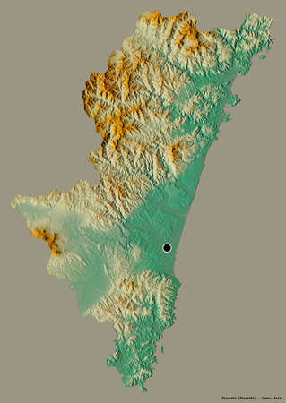
Shape of Miyazaki, prefecture of Japan, with its capital isolated on a solid color background. Topographic relief map. 3D rendering
Коллекция по умолчанию
Коллекция по умолчанию
Создать новую

Suurnes, independent town of Iceland. High resolution satellite maps
Коллекция по умолчанию
Коллекция по умолчанию
Создать новую

Shape of Savanes, region of Togo, with its capital isolated on a solid color background. Satellite imagery. 3D rendering
Коллекция по умолчанию
Коллекция по умолчанию
Создать новую

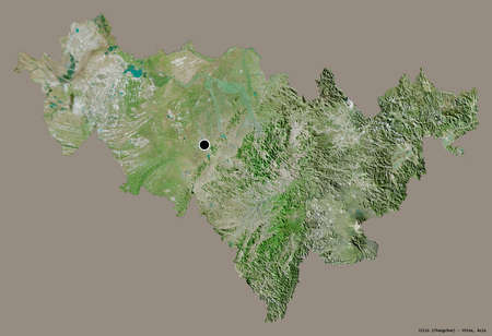
Hatay, province of Turkiye. High resolution satellite maps
Коллекция по умолчанию
Коллекция по умолчанию
Создать новую

Zimbabwe area enlarged and glowed on a darkened background of its surroundings. Satellite imagery
Коллекция по умолчанию
Коллекция по умолчанию
Создать новую
Guizhou, province of China. Sentinel-2 satellite imagery. Shape isolated on black. Description, location of the capital. Contains modified Copernicus Sentinel data
Коллекция по умолчанию
Коллекция по умолчанию
Создать новую

Isle Of Anglesey, region of Wales - Great Britain. Colored elevation map with lakes and rivers
Коллекция по умолчанию
Коллекция по умолчанию
Создать новую

Lautem, municipality of East Timor. High resolution satellite map. Locations and names of major cities of the region. Corner auxiliary location maps
Коллекция по умолчанию
Коллекция по умолчанию
Создать новую
Shape of Narok, county of Kenya, with its capital isolated on a solid color background. Satellite imagery. 3D rendering
Коллекция по умолчанию
Коллекция по умолчанию
Создать новую
Shape of Kayseri, province of Turkey, with its capital isolated on a solid color background. Satellite imagery. 3D rendering
Коллекция по умолчанию
Коллекция по умолчанию
Создать новую

Colon, province of Panama. Elevation map colored in wiki style with lakes and rivers
Коллекция по умолчанию
Коллекция по умолчанию
Создать новую

Suhaj, governorate of Egypt. Solid color shape. Locations and names of major cities of the region. Corner auxiliary location maps
Коллекция по умолчанию
Коллекция по умолчанию
Создать новую

Moneragala, district of Sri Lanka. Colored elevation map with lakes and rivers
Коллекция по умолчанию
Коллекция по умолчанию
Создать новую

Aerial view of the island in the ocean. 3D rendering
Коллекция по умолчанию
Коллекция по умолчанию
Создать новую
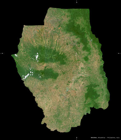
Bukidnon, province of Philippines. Sentinel-2 satellite imagery. Shape isolated on black. Description, location of the capital. Contains modified Copernicus Sentinel data
Коллекция по умолчанию
Коллекция по умолчанию
Создать новую

Brazil on digital planet Earth with international network representing communication, travel and connections. 3D illustration.
Коллекция по умолчанию
Коллекция по умолчанию
Создать новую
Shape of Jilin, province of China, with its capital isolated on a solid color background. Satellite imagery. 3D rendering
Коллекция по умолчанию
Коллекция по умолчанию
Создать новую
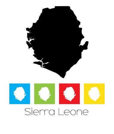
A Map of the country of Sierra Leone
Коллекция по умолчанию
Коллекция по умолчанию
Создать новую

Kenya in early morning light highlighted in red on planet Earth. 3D illustration.
Коллекция по умолчанию
Коллекция по умолчанию
Создать новую

Map of Mali on elegant shiny globe. 3D illustration
Коллекция по умолчанию
Коллекция по умолчанию
Создать новую

Calabria, region of Italy. Elevation map colored in wiki style with lakes and rivers
Коллекция по умолчанию
Коллекция по умолчанию
Создать новую

Beautiful beach in Krabi, Thailand. Aerial view from drone
Коллекция по умолчанию
Коллекция по умолчанию
Создать новую
Perak, state of Malaysia. Elevation map colored in wiki style with lakes and rivers
Коллекция по умолчанию
Коллекция по умолчанию
Создать новую

Cocle, province of Panama. Bilevel elevation map with lakes and rivers
Коллекция по умолчанию
Коллекция по умолчанию
Создать новую

Tranquil tropical oasis featuring serene island escape, clear waters, and lush greenery.
Коллекция по умолчанию
Коллекция по умолчанию
Создать новую

Moldova Map Shaded relief Color Height map on the sea Blue Background 3d illustration
Коллекция по умолчанию
Коллекция по умолчанию
Создать новую

Toliary, autonomous province of Madagascar. Elevation map colored in wiki style with lakes and rivers
Коллекция по умолчанию
Коллекция по умолчанию
Создать новую
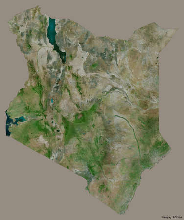
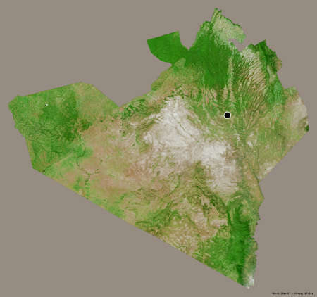
Shape of Kenya with its capital isolated on a solid color background. Satellite imagery. 3D rendering
Коллекция по умолчанию
Коллекция по умолчанию
Создать новую

Yogyakarta, special region of Indonesia. Colored elevation map with lakes and rivers
Коллекция по умолчанию
Коллекция по умолчанию
Создать новую

Aerial view of the rocky, wild coast of the Black Sea in Bulgaria, with cliffs, beaches, and green forests
Коллекция по умолчанию
Коллекция по умолчанию
Создать новую

Jamaica area map in the Azimuthal Equidistant projection. color physical map. Overlay with clean background, borders and graticule
Коллекция по умолчанию
Коллекция по умолчанию
Создать новую

Kalimantan Utara, province of Indonesia. Low resolution satellite maps
Коллекция по умолчанию
Коллекция по умолчанию
Создать новую
Songwe, region of Tanzania. High resolution satellite maps
Коллекция по умолчанию
Коллекция по умолчанию
Создать новую

Shape of Huila, department of Colombia, with its capital isolated on a solid color background. Satellite imagery. 3D rendering
Коллекция по умолчанию
Коллекция по умолчанию
Создать новую
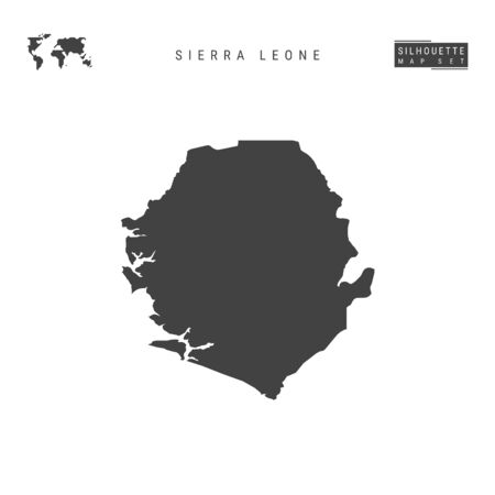
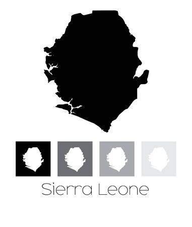
Sierra Leone Blank Vector Map Isolated on White Background. High-Detailed Black Silhouette Map of Sierra Leone.
Коллекция по умолчанию
Коллекция по умолчанию
Создать новую

Angola in early morning light highlighted in red on planet Earth. 3D illustration.
Коллекция по умолчанию
Коллекция по умолчанию
Создать новую

Bioko Sur, province of Equatorial Guinea. Open Street Map. Locations and names of major cities of the region. Corner auxiliary location maps
Коллекция по умолчанию
Коллекция по умолчанию
Создать новую

Shape of Carchi, province of Ecuador, with its capital isolated on white background. Topographic relief map. 3D rendering
Коллекция по умолчанию
Коллекция по умолчанию
Создать новую

Niigata, prefecture of Japan. Colored elevation map with lakes and rivers
Коллекция по умолчанию
Коллекция по умолчанию
Создать новую

Democratic Republic of the Congo area enlarged and glowed on a darkened background of its surroundings. Satellite imagery
Коллекция по умолчанию
Коллекция по умолчанию
Создать новую
Legion-Media
Создайте свои проекты на основе качественных стоковых фотографий и видео.


Copyright © Legion-Media.