

Oklahoma state of United States flag textile cloth fabric waving on the top sunrise mist fog
Коллекция по умолчанию
Коллекция по умолчанию
Создать новую

Oklahoma map. Poster with map of the us state in retro color palette. Shape of Oklahoma with sunburst rays background. Vector illustration.
Коллекция по умолчанию
Коллекция по умолчанию
Создать новую

October 7th, 2015 - Montreal, Canada. Old 1940s Webster's Dictionary United States of America Map Close-up
Коллекция по умолчанию
Коллекция по умолчанию
Создать новую

Oklahoma City, Oklahoma on an old torn map from 1949, isolated. Part of the old map series.
Коллекция по умолчанию
Коллекция по умолчанию
Создать новую

Counties map of Kansas USA
Коллекция по умолчанию
Коллекция по умолчанию
Создать новую

Oklahoma - U.S. state. Contour line in white and blue color on two face background. Map of The United States of America. Vector illustration.
Коллекция по умолчанию
Коллекция по умолчанию
Создать новую

State of Oklahoma. Map of Oklahoma. United States of America Oklahoma. State maps. Vector illustration
Коллекция по умолчанию
Коллекция по умолчанию
Создать новую

Map of South Dakota
Коллекция по умолчанию
Коллекция по умолчанию
Создать новую

A Map of the the United States of America with 1 state selected - Oklahoma
Коллекция по умолчанию
Коллекция по умолчанию
Создать новую

Red clerical needle on a map of the USA, Arizona and the capital Phoenix. Close up map of orizona with red tack, US map pin
Коллекция по умолчанию
Коллекция по умолчанию
Создать новую

The national flag of the United States and symbolism of each of the states.
Коллекция по умолчанию
Коллекция по умолчанию
Создать новую

Miniature people, businessman standing on map American
Коллекция по умолчанию
Коллекция по умолчанию
Создать новую

Low key picture of a fist painted in colors of american state flag of oklahoma
Коллекция по умолчанию
Коллекция по умолчанию
Создать новую

OKLAHOMA road sign against clear blue sky
Коллекция по умолчанию
Коллекция по умолчанию
Создать новую

Oklahoma on USA map with map of the state
Коллекция по умолчанию
Коллекция по умолчанию
Создать новую

Red tack in a map of Kansas City, Kansas
Коллекция по умолчанию
Коллекция по умолчанию
Создать новую

South Dakota, U.S. state, subdivided into 66 counties, multi colored political map with capital Pierre, borders and county names. North Central region of United States.
Коллекция по умолчанию
Коллекция по умолчанию
Создать новую

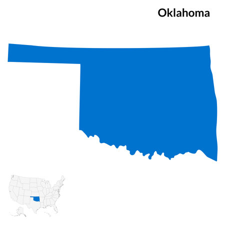
United States with selected Oklahoma map and Oklahoma flag icon. Vector map and flag.
Коллекция по умолчанию
Коллекция по умолчанию
Создать новую

Close up shot of the Japanese map.
Коллекция по умолчанию
Коллекция по умолчанию
Создать новую
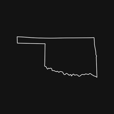
Oklahoma map on black background
Коллекция по умолчанию
Коллекция по умолчанию
Создать новую

mauritania map on a old vintage crack paper background
Коллекция по умолчанию
Коллекция по умолчанию
Создать новую

South Dakota state map with long shadow
Коллекция по умолчанию
Коллекция по умолчанию
Создать новую

Kgalagadi, district of Botswana. Low resolution satellite maps
Коллекция по умолчанию
Коллекция по умолчанию
Создать новую

Close-up 3D map of US cities, with blue lights on major hubs
Коллекция по умолчанию
Коллекция по умолчанию
Создать новую

Poster Oklahoma state map outline. Styling for tourism.
Коллекция по умолчанию
Коллекция по умолчанию
Создать новую

South Dakota county map
Коллекция по умолчанию
Коллекция по умолчанию
Создать новую

Map of Colorado
Коллекция по умолчанию
Коллекция по умолчанию
Создать новую

North Dakota vintage map. Grunge map of the us state with distressed texture. North Dakota poster. Vector illustration.
Коллекция по умолчанию
Коллекция по умолчанию
Создать новую

Red clerical needle on a map of USA, South Alabama and the capital Montgomery. Close up map of South Alabama with red tack, United States map pin USA
Коллекция по умолчанию
Коллекция по умолчанию
Создать новую

Black map of the State of North Dakota - vector illustration. Simple flat map State of North Dakota.
Коллекция по умолчанию
Коллекция по умолчанию
Создать новую

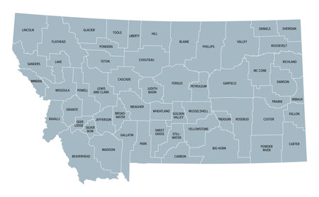
Montana, U.S. state, multi colored political map with borders, county names and Capital Helena. State in the Mountain West region of the United States, subdivided into 56 counties.
Коллекция по умолчанию
Коллекция по умолчанию
Создать новую

map of rhode island state on a old vintage crack paper background with compass
Коллекция по умолчанию
Коллекция по умолчанию
Создать новую

Travel to locations on map views paper destinations Ohio
Коллекция по умолчанию
Коллекция по умолчанию
Создать новую

Colorful Montana political map with clearly labeled, separated layers. Vector illustration.
Коллекция по умолчанию
Коллекция по умолчанию
Создать новую

Oklahoma map isolated. USA collection. Map of Oklahoma - yellow silhouette. Doodling style lettering on white
Коллекция по умолчанию
Коллекция по умолчанию
Создать новую

Close-Up map of Billings, Montana
Коллекция по умолчанию
Коллекция по умолчанию
Создать новую

Sacramento skyline in California
Коллекция по умолчанию
Коллекция по умолчанию
Создать новую

05-17-2021 Portsmouth, Hampshire, UK, Hastings Minnesota USA shown on a Geography map or road map
Коллекция по умолчанию
Коллекция по умолчанию
Создать новую

Vector illustration map Oklahoma is one of the states of America isolated on a white backgroundŒ
Коллекция по умолчанию
Коллекция по умолчанию
Создать новую
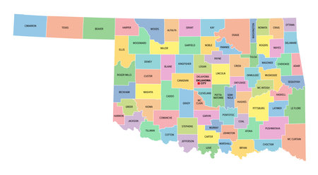
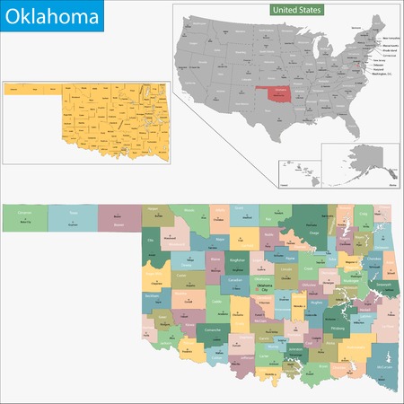
Oklahoma, U.S. state, subdivided into 77 counties, multi colored political map with capital Oklahoma City, borders and county names. State in the South Central region of USA
Коллекция по умолчанию
Коллекция по умолчанию
Создать новую

3D Montana (USA) Grunge Blueprint map with shadow
Коллекция по умолчанию
Коллекция по умолчанию
Создать новую

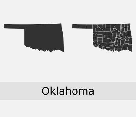
Vector map State of Oklahoma isolated on white background. Travel Vector Illustration.
Коллекция по умолчанию
Коллекция по умолчанию
Создать новую
Oklahoma word cloud
Коллекция по умолчанию
Коллекция по умолчанию
Создать новую

Vector abstract hatched map of State of Oklahoma isolated on a white background. Travel vector illustration.
Коллекция по умолчанию
Коллекция по умолчанию
Создать новую

Map of Oklahoma
Коллекция по умолчанию
Коллекция по умолчанию
Создать новую

County Cork is the point of focus on a vintage map.
Коллекция по умолчанию
Коллекция по умолчанию
Создать новую

States of America territory on white illustration.
Коллекция по умолчанию
Коллекция по умолчанию
Создать новую

Map of Greeley in Kansas
Коллекция по умолчанию
Коллекция по умолчанию
Создать новую
Montana, U.S. state, subdivided into 56 counties, gray political map with borders and county names. State in the Mountain West region of United States, nicknamed Big Sky Country.
Коллекция по умолчанию
Коллекция по умолчанию
Создать новую

U.S. states - map of Oklahoma. Hand made. Rivers and lakes are shown. Please look at my other images of cartographic series - they are all very detailed and carefully drawn by hand WITH RIVERS AND LAKES.
Коллекция по умолчанию
Коллекция по умолчанию
Создать новую

Wyoming network, constellation style us state map. Comely space style, modern design. Wyoming network map for infographics or presentation.
Коллекция по умолчанию
Коллекция по умолчанию
Создать новую

Oklahoma map icon. Oklahoma icon vector
Коллекция по умолчанию
Коллекция по умолчанию
Создать новую

05-17-2021 Portsmouth, Hampshire, UK, Cannon Falls Minnesota USA shown on a Geography map or road map
Коллекция по умолчанию
Коллекция по умолчанию
Создать новую

Red clerical needle on a map of USA, Illinois and the capital Springfield. Close up map of Illinois with red tack
Коллекция по умолчанию
Коллекция по умолчанию
Создать новую

Three-dimensional map of Kansas. USA. 3d
Коллекция по умолчанию
Коллекция по умолчанию
Создать новую

Close-Up map of Des Moines, Iowa
Коллекция по умолчанию
Коллекция по умолчанию
Создать новую
Map of Oklahoma state designed in illustration with the counties and the county seats
Коллекция по умолчанию
Коллекция по умолчанию
Создать новую

Ramadan Oklahoma With Cannon
Коллекция по умолчанию
Коллекция по умолчанию
Создать новую

illinois on old vintage map of usa with state borders
Коллекция по умолчанию
Коллекция по умолчанию
Создать новую

Three-dimensional map of Louisiana. USA. 3d
Коллекция по умолчанию
Коллекция по умолчанию
Создать новую

Map of Montana
Коллекция по умолчанию
Коллекция по умолчанию
Создать новую

Colorful North Dakota political map with clearly labeled, separated layers. Vector illustration.
Коллекция по умолчанию
Коллекция по умолчанию
Создать новую

Map of Colorado
Коллекция по умолчанию
Коллекция по умолчанию
Создать новую

Searching map of Kansas in Smartphone map application. Map of Kansas in Cell Phone. Vector illustration.
Коллекция по умолчанию
Коллекция по умолчанию
Создать новую
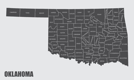
The Oklahoma state county map with labels
Коллекция по умолчанию
Коллекция по умолчанию
Создать новую

The US economy is trapped debit debt
Коллекция по умолчанию
Коллекция по умолчанию
Создать новую

Map of Oklahoma
Коллекция по умолчанию
Коллекция по умолчанию
Создать новую

Map of the world
Коллекция по умолчанию
Коллекция по умолчанию
Создать новую

Macro of Poland on a globe, narrow depth of field
Коллекция по умолчанию
Коллекция по умолчанию
Создать новую

Oklahoma - States of US Map Icon Vector Template Illustration Design. Vector EPS 10.
Коллекция по умолчанию
Коллекция по умолчанию
Создать новую

Oklahoma state map with long shadow
Коллекция по умолчанию
Коллекция по умолчанию
Создать новую

Americas map, Americas location , United States of America map
Коллекция по умолчанию
Коллекция по умолчанию
Создать новую

Close-up view of the city map of Bucharest .
Коллекция по умолчанию
Коллекция по умолчанию
Создать новую

Closeup of Philadelphia, Pennsylvania on a political map of the United States.
Коллекция по умолчанию
Коллекция по умолчанию
Создать новую

Colorado, U.S. state, subdivided into 64 counties, multi colored political map with capital Denver, borders and county names. State in the Mountain West region of Western USA.
Коллекция по умолчанию
Коллекция по умолчанию
Создать новую

05-18-2021 Portsmouth, Hampshire, UK Palmyra Missouri USA shown on a Geography map or road map
Коллекция по умолчанию
Коллекция по умолчанию
Создать новую

Glossy polygonal mesh map of Montana State with glare effect. Raster carcass map of Montana State with glowing multi colored dots for New Year illustrations. Abstract white mesh lines, triangles,
Коллекция по умолчанию
Коллекция по умолчанию
Создать новую

Map of Kansas
Коллекция по умолчанию
Коллекция по умолчанию
Создать новую

south dakota on old vintage map of usa with state borders
Коллекция по умолчанию
Коллекция по умолчанию
Создать новую

Black highlighted location map of the Harrison County inside gray map of the Federal State of Iowa, USA
Коллекция по умолчанию
Коллекция по умолчанию
Создать новую

North Dakota map. Poster with map of the us state in retro color palette. Shape of North Dakota with sunburst rays background. Vector illustration.
Коллекция по умолчанию
Коллекция по умолчанию
Создать новую

Map of Oklahoma
Коллекция по умолчанию
Коллекция по умолчанию
Создать новую

05-17-2021 Portsmouth, Hampshire, UK, Finlayson Minnesota USA shown on a Geography map or road map
Коллекция по умолчанию
Коллекция по умолчанию
Создать новую

Two versions of the map of US State Oklahoma, with the flag of Oklahoma and highlighted in dark grey. Vector map.
Коллекция по умолчанию
Коллекция по умолчанию
Создать новую
Map of Oklahoma. Oklahoma map. USA map
Коллекция по умолчанию
Коллекция по умолчанию
Создать новую

Map of USA. Image with clipping path.
Коллекция по умолчанию
Коллекция по умолчанию
Создать новую

3d isometric map of La Pampa is a province of Argentina, vector illustration
Коллекция по умолчанию
Коллекция по умолчанию
Создать новую

Journey to Nebraska, illustration with a map of Nebraska. Background with airplane, cell phone, passport, compass and tickets. Vector mockup.
Коллекция по умолчанию
Коллекция по умолчанию
Создать новую

State of Oklahoma flag waving form. Vector illustration.
Коллекция по умолчанию
Коллекция по умолчанию
Создать новую
Oklahoma maps vector outline counties, townships, regions, municipalities, departments, borders
Коллекция по умолчанию
Коллекция по умолчанию
Создать новую

Dotted and Silhouette North Dakota map
Коллекция по умолчанию
Коллекция по умолчанию
Создать новую

Map Of America
Коллекция по умолчанию
Коллекция по умолчанию
Создать новую
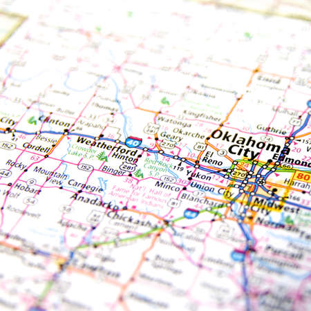
Close-Up map of Oklahoma City, Oklahoma
Коллекция по умолчанию
Коллекция по умолчанию
Создать новую

Map of South Dakota
Коллекция по умолчанию
Коллекция по умолчанию
Создать новую

Red clerical needle on a map of USA, South Alabama and the capital Montgomery. Close up map of South Alabama with red tack, United States map pin USA
Коллекция по умолчанию
Коллекция по умолчанию
Создать новую

Equatorial Guinea Map World map News Communication delivery blue
Коллекция по умолчанию
Коллекция по умолчанию
Создать новую

map of Colorado
Коллекция по умолчанию
Коллекция по умолчанию
Создать новую

Vilnius, Lithuania - July 5, 2016: Sunset Sunrise Dawn Over Cityscape In Evening Summer. Beautiful View Of Modern Office Buildings Skyscrapers In Business District New City Centre Shnipishkes
Коллекция по умолчанию
Коллекция по умолчанию
Создать новую

Highly detailed editable political map with separated layers. Oklahoma.
Коллекция по умолчанию
Коллекция по умолчанию
Создать новую

Network map of South Dakota. Us state digital connections map. Technology, internet, network, telecommunication concept. Vector illustration.
Коллекция по умолчанию
Коллекция по умолчанию
Создать новую
Legion-Media
Создайте свои проекты на основе качественных стоковых фотографий и видео.


Copyright © Legion-Media.