

On The World Map-Geo Political Map
Коллекция по умолчанию
Коллекция по умолчанию
Создать новую
Rotorua On The World Map-Geo Political Map
Коллекция по умолчанию
Коллекция по умолчанию
Создать новую

Red marker over Guyana
Коллекция по умолчанию
Коллекция по умолчанию
Создать новую

Sunrise above Uruguay highlighted in red on model of planet Earth in space with visible country borders. 3D illustration.
Коллекция по умолчанию
Коллекция по умолчанию
Создать новую

Cuba as seen from Earth’s orbit on planet Earth highlighted in red with visible borders. 3D illustration.
Коллекция по умолчанию
Коллекция по умолчанию
Создать новую

Jamaica on model of Earth with watery oceans and realistic clouds in the atmosphere. 3D illustration with detailed planet surface.
Коллекция по умолчанию
Коллекция по умолчанию
Создать новую

New Ireland, province of Papua New Guinea. High resolution satellite maps
Коллекция по умолчанию
Коллекция по умолчанию
Создать новую

Mauritania on colorful political globe. 3D illustration
Коллекция по умолчанию
Коллекция по умолчанию
Создать новую

Brazil on the map. Brazil on the world map.
Коллекция по умолчанию
Коллекция по умолчанию
Создать новую

A macro photograph of a world map highlighting the country of Turkey.
Коллекция по умолчанию
Коллекция по умолчанию
Создать новую

close up of a map with Costa Rica in focus and sea shells in the frame
Коллекция по умолчанию
Коллекция по умолчанию
Создать новую

Vintage 1956 map: Northern Europe
Коллекция по умолчанию
Коллекция по умолчанию
Создать новую

Orographic map of the southern region of Portugal. With references in Spanish. Concept of cartography, travel, tourism, geography. differential focus
Коллекция по умолчанию
Коллекция по умолчанию
Создать новую

Vector wireframe mesh polygonal of malta map. Abstract global connection structure. Map connected with lines and dots. Geometric world concept. digital data visualization, infographics.
Коллекция по умолчанию
Коллекция по умолчанию
Создать новую

Cagayan, province of Philippines. High resolution satellite maps
Коллекция по умолчанию
Коллекция по умолчанию
Создать новую

Selective focus on map of Telengana - a state of India
Коллекция по умолчанию
Коллекция по умолчанию
Создать новую

Shape of the Molucca Sea tectonic plate on the Wiki style elevation map in the Patterson Cylindrical (oblique) projection
Коллекция по умолчанию
Коллекция по умолчанию
Создать новую

Malta network map. Abstract geometric map of the island. Digital connections and telecommunication design. Glowing internet network. Elegant vector illustration.
Коллекция по умолчанию
Коллекция по умолчанию
Создать новую

Queensland, state of Australia. Colored elevation map with lakes and rivers
Коллекция по умолчанию
Коллекция по умолчанию
Создать новую

Equatorial Guinea on planet Earth from space with network. Concept of international communication, technology and travel. 3D illustration.
Коллекция по умолчанию
Коллекция по умолчанию
Создать новую

05-18-2021 Portsmouth, Hampshire, UK, Vienna Missouri USA shown on a Geography map or road map
Коллекция по умолчанию
Коллекция по умолчанию
Создать новую

Nepal on model of Earth with watery oceans and realistic clouds in the atmosphere. 3D illustration with detailed planet surface.
Коллекция по умолчанию
Коллекция по умолчанию
Создать новую

Macro of Poland on a globe, narrow depth of field
Коллекция по умолчанию
Коллекция по умолчанию
Создать новую

Queen Maud Land On The World Map Colorful Geo Political World Map
Коллекция по умолчанию
Коллекция по умолчанию
Создать новую

Hand placing a thermometer on a little model globe
Коллекция по умолчанию
Коллекция по умолчанию
Создать новую

Venezuela in early morning light highlighted in red on planet Earth with visible border lines and city lights. 3D illustration.
Коллекция по умолчанию
Коллекция по умолчанию
Создать новую

New Zealand on model of Earth. 3D illustration with realistic planet surface.
Коллекция по умолчанию
Коллекция по умолчанию
Создать новую

Indonesia highlighted in red on planet Earth. 3D illustration.
Коллекция по умолчанию
Коллекция по умолчанию
Создать новую

French Guiana from orbit of planet Earth at night with visible borderlines and city lights. 3D illustration.
Коллекция по умолчанию
Коллекция по умолчанию
Создать новую

Old map of world. Journey and discovery concept
Коллекция по умолчанию
Коллекция по умолчанию
Создать новую

representation of gun control in the United States of America with USA map background
Коллекция по умолчанию
Коллекция по умолчанию
Создать новую

Generative AI
Коллекция по умолчанию
Коллекция по умолчанию
Создать новую

Aerial sunrise panorama of Cabo de Sao Vicente Cape St Vincent mediterranean Algarve cliff atlantic coast beach Sagres
Коллекция по умолчанию
Коллекция по умолчанию
Создать новую

3D map showcasing mountains, valleys, and paths with vibrant details.
Коллекция по умолчанию
Коллекция по умолчанию
Создать новую

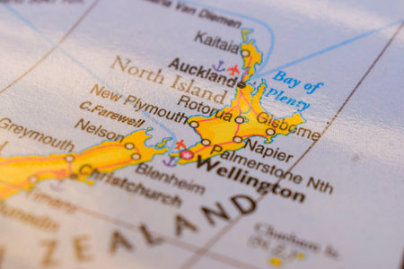
World map with the country of New Zealand in focus
Коллекция по умолчанию
Коллекция по умолчанию
Создать новую

red pin placed selective at sri lanka map. - economic and business concept.
Коллекция по умолчанию
Коллекция по умолчанию
Создать новую

Caribbean from space on model of Earth with international network. Concept of digital communication or travel. 3D illustration.
Коллекция по умолчанию
Коллекция по умолчанию
Создать новую

Costa Rica from space with highly detailed surface textures and visible country borders. 3D illustration.
Коллекция по умолчанию
Коллекция по умолчанию
Создать новую

Choco, Department of Colombia. Colored elevation map with lakes and rivers
Коллекция по умолчанию
Коллекция по умолчанию
Создать новую
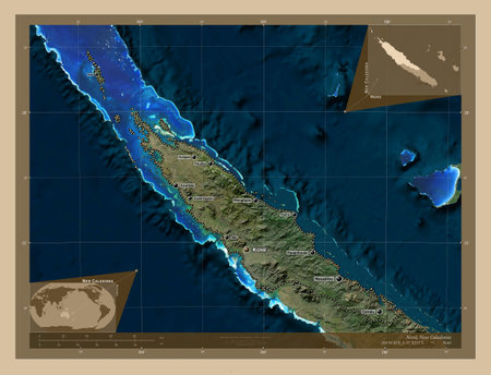
Nord, province of New Caledonia. Low resolution satellite map. Locations and names of major cities of the region. Corner auxiliary location maps
Коллекция по умолчанию
Коллекция по умолчанию
Создать новую

Hand marking Paris on map with red pin
Коллекция по умолчанию
Коллекция по умолчанию
Создать новую

Satellite view of Mozambique from space at night. Beautifully detailed plastic planet surface with visible city lights. 3D illustration.
Коллекция по умолчанию
Коллекция по умолчанию
Создать новую

Hawaii map part of a world globe
Коллекция по умолчанию
Коллекция по умолчанию
Создать новую

Paraguay at night from space with visible country borders. 3D illustration.
Коллекция по умолчанию
Коллекция по умолчанию
Создать новую

Peru from space on model of blue digital planet Earth. Concept of blue digital technology, connectivity and travel. 3D illustration.
Коллекция по умолчанию
Коллекция по умолчанию
Создать новую

Honduras from space on model of planet Earth with network. Concept of digital technology, connectivity and travel. 3D illustration.
Коллекция по умолчанию
Коллекция по умолчанию
Создать новую

Space orbit view of Belize highlighted in red on planet Earth with visible borders. 3D illustration.
Коллекция по умолчанию
Коллекция по умолчанию
Создать новую

Leyte, province of Philippines. Low resolution satellite maps
Коллекция по умолчанию
Коллекция по умолчанию
Создать новую

Biliran, province of Philippines. High resolution satellite maps
Коллекция по умолчанию
Коллекция по умолчанию
Создать новую

Location New Caledonia France, map with push pin closeup, travel and journey concept
Коллекция по умолчанию
Коллекция по умолчанию
Создать новую

magnifying glass on the world map selective focus at Papua new guinea map. - travel and business concept.
Коллекция по умолчанию
Коллекция по умолчанию
Создать новую

Flag of New Caledonia in grunge style with waving effect, vector grunge brush stroke flag.
Коллекция по умолчанию
Коллекция по умолчанию
Создать новую

map of Monte Carlo in Monaco through magnifying glass, concept of planning the travel itinerary
Коллекция по умолчанию
Коллекция по умолчанию
Создать новую

Ghana. Neighborhood - distant perspective with outline of the country. color physical map
Коллекция по умолчанию
Коллекция по умолчанию
Создать новую

An opt art 3d rendering of a world map bent forward, with a light blue network, bright and curvy blue mass media links, yellow urban areas in the blue grid.
Коллекция по умолчанию
Коллекция по умолчанию
Создать новую

Passport world map for stock
Коллекция по умолчанию
Коллекция по умолчанию
Создать новую

Oman at night from space with visible country borders. 3D illustration.
Коллекция по умолчанию
Коллекция по умолчанию
Создать новую

physical map of russia with cities
Коллекция по умолчанию
Коллекция по умолчанию
Создать новую

remote island with crystal-clear water and towering rock formations, created with generative ai
Коллекция по умолчанию
Коллекция по умолчанию
Создать новую

Madagascar on model of green planet Earth with international networks. Concept of digital communication and technology. 3D illustration.
Коллекция по умолчанию
Коллекция по умолчанию
Создать новую

Chittagong, division of Bangladesh. Colored elevation map with lakes and rivers
Коллекция по умолчанию
Коллекция по умолчанию
Создать новую

Liberia on blue digital planet Earth with international network representing communication, travel and connections. 3D illustration.
Коллекция по умолчанию
Коллекция по умолчанию
Создать новую

Eritrea and Bermuda two folded flags together
Коллекция по умолчанию
Коллекция по умолчанию
Создать новую

Madagascar on model of planet Earth with international networks. Concept of digital communication and technology. 3D illustration.
Коллекция по умолчанию
Коллекция по умолчанию
Создать новую

Vintage Travel Map With The Word Explore Spelled Out, Symbolizing Adventure And Exploration
Коллекция по умолчанию
Коллекция по умолчанию
Создать новую

Guyana on planet Earth from space with network. Concept of international communication, technology and travel. 3D illustration.
Коллекция по умолчанию
Коллекция по умолчанию
Создать новую

Outline of the Molucca Sea tectonic plate with the borders of surrounding plates against the background of a satellite map. 3D rendering
Коллекция по умолчанию
Коллекция по умолчанию
Создать новую

Mauritania on planet Earth from space with network. Concept of international communication, technology and travel. 3D illustration.
Коллекция по умолчанию
Коллекция по умолчанию
Создать новую

Map of Malaysia through magnifying glass.Close-up.
Коллекция по умолчанию
Коллекция по умолчанию
Создать новую

Canberra On The World Map-Geo Political Map
Коллекция по умолчанию
Коллекция по умолчанию
Создать новую

Old map.
Коллекция по умолчанию
Коллекция по умолчанию
Создать новую

Location of England on the World Map with Enlarged Map of England with Flag. Geographical Vector Template for your design.
Коллекция по умолчанию
Коллекция по умолчанию
Создать новую

Baja California, state of Mexico. Colored relief with lakes and rivers. Shape presented against its country area with informative overlays. 3D rendering
Коллекция по умолчанию
Коллекция по умолчанию
Создать новую

Industrial lettering design. Energy generation and heavy industry development concept
Коллекция по умолчанию
Коллекция по умолчанию
Создать новую

Rivas, department of Nicaragua. High resolution satellite map. Locations and names of major cities of the region. Corner auxiliary location maps
Коллекция по умолчанию
Коллекция по умолчанию
Создать новую

Samar, province of Philippines. Elevation map colored in wiki style with lakes and rivers
Коллекция по умолчанию
Коллекция по умолчанию
Создать новую

Saskatchewan on administration map of canada with flags
Коллекция по умолчанию
Коллекция по умолчанию
Создать новую

Island of Dominican Republic on a map with Santo Domingo in focus
Коллекция по умолчанию
Коллекция по умолчанию
Создать новую

Madagascar on model of green planet Earth with international networks. Concept of digital communication and technology. 3D illustration.
Коллекция по умолчанию
Коллекция по умолчанию
Создать новую

Ivory Coast on blue digital planet Earth from space with network. Concept of international communication, technology and travel. 3D illustration.
Коллекция по умолчанию
Коллекция по умолчанию
Создать новую

United Kingdom map, mountains,rivers.
Коллекция по умолчанию
Коллекция по умолчанию
Создать новую

Bermuda flag waving in the wind against blurred modern building. Business concept. National cooperation theme.
Коллекция по умолчанию
Коллекция по умолчанию
Создать новую

Cambodia and Virgin Islands British two folded flags together
Коллекция по умолчанию
Коллекция по умолчанию
Создать новую

Caribbean from space on model of Earth during sunset with international network. Concept of digital communication or travel. 3D illustration.
Коллекция по умолчанию
Коллекция по умолчанию
Создать новую

Liberia from orbit of planet Earth at night with highly detailed surface textures. 3D illustration.
Коллекция по умолчанию
Коллекция по умолчанию
Создать новую

Colombia from space on realistic model of planet Earth with network. Concept of digital technology, connectivity and travel. 3D illustration.
Коллекция по умолчанию
Коллекция по умолчанию
Создать новую

Costa Rica on green model of planet Earth with network at night. Concept of digital technology, communication and travel. 3D illustration.
Коллекция по умолчанию
Коллекция по умолчанию
Создать новую

Map of the world
Коллекция по умолчанию
Коллекция по умолчанию
Создать новую

Istarska, county of Croatia. Colored elevation map with lakes and rivers
Коллекция по умолчанию
Коллекция по умолчанию
Создать новую

Abstract of malta map network, internet and global connection concept, Wire Frame 3D mesh polygonal network line, design sphere, dot and structure. Vector illustration eps 10.
Коллекция по умолчанию
Коллекция по умолчанию
Создать новую

a close up of South Africa on a map
Коллекция по умолчанию
Коллекция по умолчанию
Создать новую

Haiti Haitian flag on the map of Caribbean and Central America
Коллекция по умолчанию
Коллекция по умолчанию
Создать новую

Map of the world
Коллекция по умолчанию
Коллекция по умолчанию
Создать новую

Buenos Aires, province of Argentina. Colored elevation map with lakes and rivers. Corner auxiliary location maps
Коллекция по умолчанию
Коллекция по умолчанию
Создать новую

IRELAND country on the world map macro photo, close-up.
Коллекция по умолчанию
Коллекция по умолчанию
Создать новую

Three passports on the background of the world map. The journey begins.
Коллекция по умолчанию
Коллекция по умолчанию
Создать новую

Andhra Pradesh, state of India. Colored elevation map with lakes and rivers. Locations and names of major cities of the region. Corner auxiliary location maps
Коллекция по умолчанию
Коллекция по умолчанию
Создать новую

North Sulawesi, province of Indonesia. Colored relief with lakes and rivers. Shape presented against its country area with informative overlays. 3D rendering
Коллекция по умолчанию
Коллекция по умолчанию
Создать новую

Brooklyn, New York is the center of focus on an old map.
Коллекция по умолчанию
Коллекция по умолчанию
Создать новую

United Kingdom and Democratic Republic of Congo flags for official meeting against background of world map.
Коллекция по умолчанию
Коллекция по умолчанию
Создать новую
Legion-Media
Создайте свои проекты на основе качественных стоковых фотографий и видео.


Copyright © Legion-Media.