

Satellite view of Bhutan highlighted in red on planet Earth with borderlines. 3D illustration.
Коллекция по умолчанию
Коллекция по умолчанию
Создать новую

Kuala Lumpur, Malaysia - February 11, 2016: Ancient map of Southeast Asia at the Islamic Arts Museum in Kuala Lumpur, Malaysia
Коллекция по умолчанию
Коллекция по умолчанию
Создать новую

Brooklyn, New York is the center of focus on an old map.
Коллекция по умолчанию
Коллекция по умолчанию
Создать новую

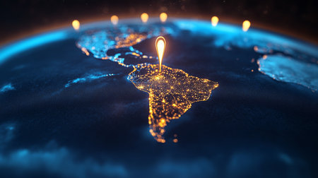
Sunrise above Uruguay highlighted in red on model of planet Earth in space with visible country borders. 3D illustration.
Коллекция по умолчанию
Коллекция по умолчанию
Создать новую

Imitation of antique map on birch cork and feather
Коллекция по умолчанию
Коллекция по умолчанию
Создать новую

The focus is on Mexico on this vintage map.
Коллекция по умолчанию
Коллекция по умолчанию
Создать новую

Shape of Carchi, province of Ecuador, with its capital isolated on white background. Colored elevation map. 3D rendering
Коллекция по умолчанию
Коллекция по умолчанию
Создать новую

Assam, state of India. Colored elevation map with lakes and rivers
Коллекция по умолчанию
Коллекция по умолчанию
Создать новую

old terrestrial globe detail close up cook islands
Коллекция по умолчанию
Коллекция по умолчанию
Создать новую

Vintage Travel Map With The Word Explore Spelled Out, Symbolizing Adventure And Exploration
Коллекция по умолчанию
Коллекция по умолчанию
Создать новую

Kyrgyzstan in red color on simple elegant political globe. 3D illustration
Коллекция по умолчанию
Коллекция по умолчанию
Создать новую

China old map
Коллекция по умолчанию
Коллекция по умолчанию
Создать новую

View of the Pashupatinath temple in the morning
Коллекция по умолчанию
Коллекция по умолчанию
Создать новую

Bangladesh highlighted in red on planet Earth. 3D illustration.
Коллекция по умолчанию
Коллекция по умолчанию
Создать новую

Sunrise in Annapurna area mountains in the Himalayas of Nepal
Коллекция по умолчанию
Коллекция по умолчанию
Создать новую

Bhutan highlighted in red from Earth’s orbit at night with visible country borders. 3D illustration.
Коллекция по умолчанию
Коллекция по умолчанию
Создать новую

Burkina Faso from orbit of planet Earth in sunrise with highly detailed surface textures and visible country borders. 3D illustration.
Коллекция по умолчанию
Коллекция по умолчанию
Создать новую

Nepal from space on model of planet Earth with country borders. 3D illustration.
Коллекция по умолчанию
Коллекция по умолчанию
Создать новую

India, China, Thailand on the globe
Коллекция по умолчанию
Коллекция по умолчанию
Создать новую

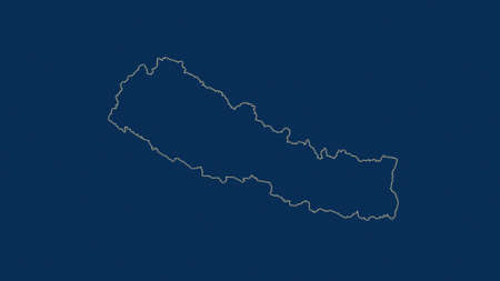
Hand drawn of Nepal map, vector illustration
Коллекция по умолчанию
Коллекция по умолчанию
Создать новую

Shape of Carchi, province of Ecuador, with its capital isolated on white background. Topographic relief map. 3D rendering
Коллекция по умолчанию
Коллекция по умолчанию
Создать новую

Black Sea and Crimea vintage map
Коллекция по умолчанию
Коллекция по умолчанию
Создать новую

Pray for Nepal. Earthquake Crisis
Коллекция по умолчанию
Коллекция по умолчанию
Создать новую

Central African Republic, shaded relief map. Surrounding territory greyed out. Colored according to vegetation. Includes clip path for the state area.
Projection: Mercator
Extents: 13/28.5/1.2/12.5
Data source: NASA
Коллекция по умолчанию
Коллекция по умолчанию
Создать новую

Hand marking Paris on map with red pin
Коллекция по умолчанию
Коллекция по умолчанию
Создать новую

Macro of Poland on a globe, narrow depth of field
Коллекция по умолчанию
Коллекция по умолчанию
Создать новую

3D map showcasing mountains, valleys, and paths with vibrant details.
Коллекция по умолчанию
Коллекция по умолчанию
Создать новую

Shape of Graubünden, canton of Switzerland, with its capital isolated on white background. Bilevel elevation map. 3D rendering
Коллекция по умолчанию
Коллекция по умолчанию
Создать новую

Evening over Bangladesh as seen from space on planet Earth. 3D illustration.
Коллекция по умолчанию
Коллекция по умолчанию
Создать новую

Bhutan in red on political map with transparent oceans. 3D illustration.
Коллекция по умолчанию
Коллекция по умолчанию
Создать новую

Red marker over Guyana
Коллекция по умолчанию
Коллекция по умолчанию
Создать новую

Lesotho.
Коллекция по умолчанию
Коллекция по умолчанию
Создать новую
3d isometric Map of Basel-Stadt is a region of Switzerland with national flag
Коллекция по умолчанию
Коллекция по умолчанию
Создать новую

22 Dec 2010 Langar Hall. Gurdwara Nanak Jhira Sahib dedicated to the first Sikh guru Guru Nanak Bidar Karnataka India
Коллекция по умолчанию
Коллекция по умолчанию
Создать новую

Beautiful view of the river and mountains in Sapa, Vietnam
Коллекция по умолчанию
Коллекция по умолчанию
Создать новую

Red wooden house with flowerbed in autumn.
Коллекция по умолчанию
Коллекция по умолчанию
Создать новую

Close up of finger pointing to Helsinki, Finland on colorful map, background blur
Коллекция по умолчанию
Коллекция по умолчанию
Создать новую

Bringing global network and data exchanges to life through 3D rendering.
Коллекция по умолчанию
Коллекция по умолчанию
Создать новую

Flat lay of a tourist map of Tenerife along with sunglasses, a camera and a book of photographs dedicated to the Canary Island
Коллекция по умолчанию
Коллекция по умолчанию
Создать новую

World map with focus on Mongolia with capital city Ulan Bator. Red triangle pin points on it.
Коллекция по умолчанию
Коллекция по умолчанию
Создать новую

A map depicting a mountain range with a serene lake in the middle. This image can be used for travel brochures, adventure websites, or educational materials about geography and topography.
Коллекция по умолчанию
Коллекция по умолчанию
Создать новую

Guyana highlighted in red on planet Earth at night with visible borders and city lights. 3D illustration.
Коллекция по умолчанию
Коллекция по умолчанию
Создать новую

Area of Independencia, province of Dominican Republic, isolated on a solid background in a georeferenced bounding box. Labels. Colored elevation map. 3D rendering
Коллекция по умолчанию
Коллекция по умолчанию
Создать новую

Vintage globe
Коллекция по умолчанию
Коллекция по умолчанию
Создать новую

Sicily, autonomous region of Italy. Grayscale elevation map with lakes and rivers
Коллекция по умолчанию
Коллекция по умолчанию
Создать новую

Illuminated Belgium Data Map Highlighting Geographical Features Neon Glow Light 3D Illustration
Коллекция по умолчанию
Коллекция по умолчанию
Создать новую

Close up shot of the Japanese map.
Коллекция по умолчанию
Коллекция по умолчанию
Создать новую
Blue Kashmir 3d map with pointer pin surrounded with other countries in white. Political map with borders. 3d render illustration
Коллекция по умолчанию
Коллекция по умолчанию
Создать новую

A closeup map of Europe found on a globe of the Earth.
Коллекция по умолчанию
Коллекция по умолчанию
Создать новую

Old map of world. Journey and discovery concept
Коллекция по умолчанию
Коллекция по умолчанию
Создать новую

Vector wireframe mesh polygonal of malta map. Abstract global connection structure. Map connected with lines and dots. Geometric world concept. digital data visualization, infographics.
Коллекция по умолчанию
Коллекция по умолчанию
Создать новую

Maga Buryatdan, region of Russia. Colored shader data with lakes and rivers. Shape outlined against its country area. 3D rendering
Коллекция по умолчанию
Коллекция по умолчанию
Создать новую

Man planning trip and pointing a place where he want to go
Коллекция по умолчанию
Коллекция по умолчанию
Создать новую

Compostela Valley, province of Philippines. Elevation map colored in wiki style with lakes and rivers
Коллекция по умолчанию
Коллекция по умолчанию
Создать новую

Myanmar in red at night as seen from Earth's orbit in space. 3D illustration with highly detailed realistic planet surface. Elements of this image furnished by NASA.
Коллекция по умолчанию
Коллекция по умолчанию
Создать новую
Henan, province of China. Colored elevation map with lakes and rivers
Коллекция по умолчанию
Коллекция по умолчанию
Создать новую

Nature Landscape with mountain background along the highway in Leh Ladakh, India
Коллекция по умолчанию
Коллекция по умолчанию
Создать новую
Chechnya, republic of Russia. Colored elevation map with lakes and rivers
Коллекция по умолчанию
Коллекция по умолчанию
Создать новую

Image of fingerprint bionic security system over blue landscape with diverse data. Global business and digital interface concept digitally generated image.
Коллекция по умолчанию
Коллекция по умолчанию
Создать новую

Hormozgan, province of Iran. Low resolution satellite map. Locations and names of major cities of the region. Corner auxiliary location maps
Коллекция по умолчанию
Коллекция по умолчанию
Создать новую
Captivating Aerial View of Urban Landscapes with Geospatial Imagery Over Major Cities and Landmarks
Коллекция по умолчанию
Коллекция по умолчанию
Создать новую

A landscape of a village situated at the top of a mountain.
Коллекция по умолчанию
Коллекция по умолчанию
Создать новую
Presovsky, region of Slovakia. Colored elevation map with lakes and rivers
Коллекция по умолчанию
Коллекция по умолчанию
Создать новую

Cropped image of man holding the world map in hands while standing near private plane in airport. Choosing the next destination.
Коллекция по умолчанию
Коллекция по умолчанию
Создать новую

Simple line drawing illustration map of sightseeing spots in Gifu Prefecture in autumn
Коллекция по умолчанию
Коллекция по умолчанию
Создать новую

Moldova Map Shaded relief Color Height map on the sea Blue Background 3d illustration
Коллекция по умолчанию
Коллекция по умолчанию
Создать новую

Nicaragua map blackboard chalkboard raster
Коллекция по умолчанию
Коллекция по умолчанию
Создать новую

Leh palace in Leh Ladakh with prayer flags
Коллекция по умолчанию
Коллекция по умолчанию
Создать новую
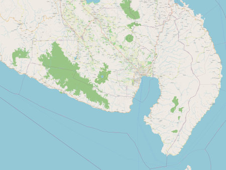
Sarangani, province of Philippines. Open Street Map
Коллекция по умолчанию
Коллекция по умолчанию
Создать новую
Nepal area map in the Azimuthal Equidistant projection. shapes only - land/ocean mask. Clean shape without borders
Коллекция по умолчанию
Коллекция по умолчанию
Создать новую

Myanmar area map in the Azimuthal Equidistant projection. topographic relief map. Full composition of rasters with borders, main cities, capital name and graticule
Коллекция по умолчанию
Коллекция по умолчанию
Создать новую

Passport of a citizen of Ukraine near the globe with a baseball cap.
Коллекция по умолчанию
Коллекция по умолчанию
Создать новую

Mexico from space with highly detailed surface textures and visible country borders. 3D illustration.
Коллекция по умолчанию
Коллекция по умолчанию
Создать новую
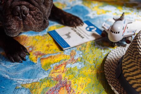
French bulldog is thinking of Far-off Destinations
Коллекция по умолчанию
Коллекция по умолчанию
Создать новую

3d isometric map of Nepal isolated with shadow. paper card style vector illustration
Коллекция по умолчанию
Коллекция по умолчанию
Создать новую

Malta political map of administrative divisions - regions. 3D colorful vector map with name labels.
Коллекция по умолчанию
Коллекция по умолчанию
Создать новую

Brazil on digital planet Earth with international network representing communication, travel and connections. 3D illustration.
Коллекция по умолчанию
Коллекция по умолчанию
Создать новую
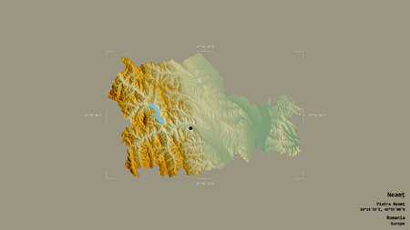
Area of NeamÈ›, county of Romania, isolated on a solid background in a georeferenced bounding box. Labels. Topographic relief map. 3D rendering
Коллекция по умолчанию
Коллекция по умолчанию
Создать новую

Brinchang Sunrise
Коллекция по умолчанию
Коллекция по умолчанию
Создать новую

Buddhist prayer flags and mount Everest
Коллекция по умолчанию
Коллекция по умолчанию
Создать новую

Night view of Nepal from space with visible city lights. Very detailed plastic planet surface. 3D illustration.
Коллекция по умолчанию
Коллекция по умолчанию
Создать новую

international network representing communication, travel and connections.
Коллекция по умолчанию
Коллекция по умолчанию
Создать новую

Map with compass
Коллекция по умолчанию
Коллекция по умолчанию
Создать новую

old political map of asia with flag of india
Коллекция по умолчанию
Коллекция по умолчанию
Создать новую
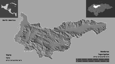
Shape of Yoro, department of Honduras, and its capital. Distance scale, previews and labels. Bilevel elevation map. 3D rendering
Коллекция по умолчанию
Коллекция по умолчанию
Создать новую

Relief map of Swizerland, the nearby countries are implied.
Коллекция по умолчанию
Коллекция по умолчанию
Создать новую

Walking tour of famous city places of Kathmandu Valley.
Коллекция по умолчанию
Коллекция по умолчанию
Создать новую

POKHARA, NEPAL - CIRCA NOVEMBER 2013: view of the lake in Pokhara circa November 2013 in Pokhara.
Коллекция по умолчанию
Коллекция по умолчанию
Создать новую

La Vega, province of Dominican Republic. Colored elevation map with lakes and rivers. Locations and names of major cities of the region. Corner auxiliary location maps
Коллекция по умолчанию
Коллекция по умолчанию
Создать новую

Passports of citizens of different countries of the world, background consisting of passports of several countries.
Коллекция по умолчанию
Коллекция по умолчанию
Создать новую

India map showing international connections and data flow
Коллекция по умолчанию
Коллекция по умолчанию
Создать новую

Bandipur Nepal October 15, 2018 Closeup of young children playing and having fun together in Bandipur in the afternoon
Коллекция по умолчанию
Коллекция по умолчанию
Создать новую
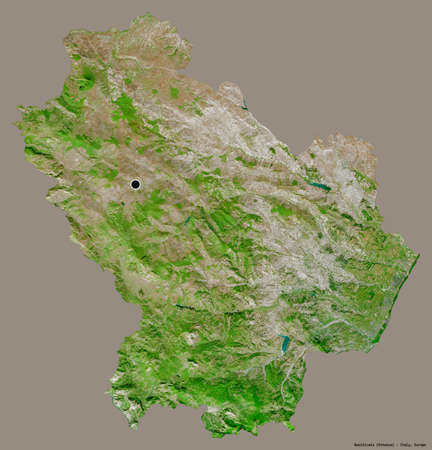
Shape of Basilicata, region of Italy, with its capital isolated on a solid color background. Satellite imagery. 3D rendering
Коллекция по умолчанию
Коллекция по умолчанию
Создать новую
Thai Nguyen, province of Vietnam. Colored elevation map with lakes and rivers
Коллекция по умолчанию
Коллекция по умолчанию
Создать новую

Mali from space on realistic model of planet Earth with network. Concept of digital technology, connectivity and travel. 3D illustration.
Коллекция по умолчанию
Коллекция по умолчанию
Создать новую

Stupa and prayer flags at sunset in Himalayas, Nepal
Коллекция по умолчанию
Коллекция по умолчанию
Создать новую

Passport world map for stock
Коллекция по умолчанию
Коллекция по умолчанию
Создать новую

India as seen from Earth’s orbit on planet Earth at night highlighted in red with visible borders and city lights. 3D illustration.
Коллекция по умолчанию
Коллекция по умолчанию
Создать новую
Shape of SÆ¡n La, province of Vietnam, with its capital isolated on a solid color background. Satellite imagery. 3D rendering
Коллекция по умолчанию
Коллекция по умолчанию
Создать новую

yellowish mountain road view in tibet of China
Коллекция по умолчанию
Коллекция по умолчанию
Создать новую
Legion-Media
Создайте свои проекты на основе качественных стоковых фотографий и видео.


Copyright © Legion-Media.