

Close up to a Port Vila city with a yellow pin needle into Vanuatu country political map
Коллекция по умолчанию
Коллекция по умолчанию
Создать новую
Northam-Australia Political Map Or Administrative Map With Blurry Background Image
Коллекция по умолчанию
Коллекция по умолчанию
Создать новую

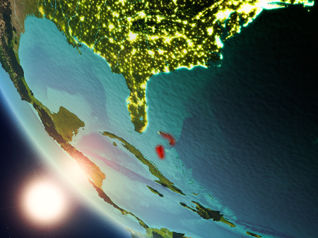
Map of Jamaica highlighted in red on simple shiny metallic map with clear country borders. 3D illustration
Коллекция по умолчанию
Коллекция по умолчанию
Создать новую
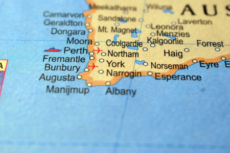
York-Political Map Or Administrative Map Of Australia With Background Blur Image
Коллекция по умолчанию
Коллекция по умолчанию
Создать новую
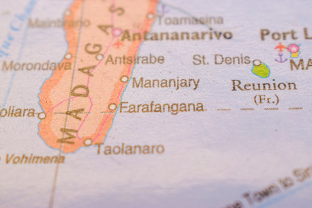
Mananjary On The World Map-Geo Political Map
Коллекция по умолчанию
Коллекция по умолчанию
Создать новую

Bali Pin point city famous name of indonesia
Коллекция по умолчанию
Коллекция по умолчанию
Создать новую
Labuan, federal territory of Malaysia. High resolution satellite maps
Коллекция по умолчанию
Коллекция по умолчанию
Создать новую

A close up shot of Budapest, capital city of Hungary.
Коллекция по умолчанию
Коллекция по умолчанию
Создать новую
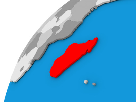
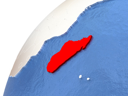
Madagascar highlighted in red on globe with visible country borders. 3D illustration
Коллекция по умолчанию
Коллекция по умолчанию
Создать новую
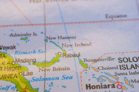
Rabaul On The World Map-Geo Political Map
Коллекция по умолчанию
Коллекция по умолчанию
Создать новую

Northland, regional council of New Zealand. Low resolution satellite maps
Коллекция по умолчанию
Коллекция по умолчанию
Создать новую

Vieques, municipality of Puerto Rico. Low resolution satellite maps
Коллекция по умолчанию
Коллекция по умолчанию
Создать новую

closeup of miniature figurine of young traveller standing on big map Madagascar
Коллекция по умолчанию
Коллекция по умолчанию
Создать новую

View of Malaysia on the World Map. Geographical view altered on colors, perspective and focus on the edge. Names can be partial or incomplete. Ukrainian map. Selective focus
Коллекция по умолчанию
Коллекция по умолчанию
Создать новую
Summer animals tropical leaf seamless pattern. Hand drawn african print. Beach vacation background design, savannah textile print. Cheetah and hippopotamus exotic wallpaper, baby apparel safari motif
Коллекция по умолчанию
Коллекция по умолчанию
Создать новую
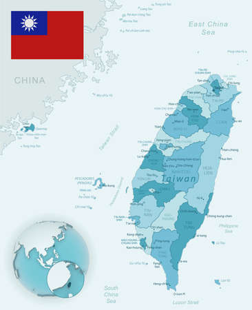
Blue-green detailed map of Taiwan administrative divisions with country flag and location on the globe. Vector illustration
Коллекция по умолчанию
Коллекция по умолчанию
Создать новую

Minorca network map. Abstract geometric map of the island. Digital connections and telecommunication design. Glowing internet network. Superb vector illustration.
Коллекция по умолчанию
Коллекция по умолчанию
Создать новую

very big size illustration samoa country map with flag
Коллекция по умолчанию
Коллекция по умолчанию
Создать новую

Malta network map. Abstract geometric map of the island. Digital connections and telecommunication design. Glowing internet network. Elegant vector illustration.
Коллекция по умолчанию
Коллекция по умолчанию
Создать новую
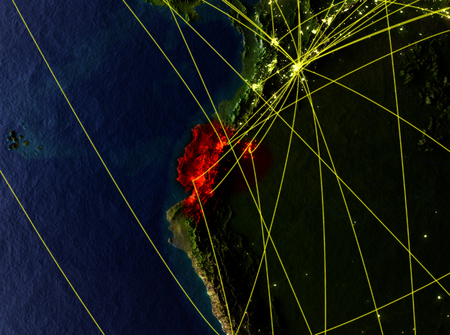
Ecuador from space on model of planet Earth with networks. Detailed planet surface with city lights. 3D illustration.
Коллекция по умолчанию
Коллекция по умолчанию
Создать новую

Image of fingerprint bionic security system over blue landscape with diverse data. Global business and digital interface concept digitally generated image.
Коллекция по умолчанию
Коллекция по умолчанию
Создать новую

High Detailed Vector Map - Heard Island and McDonald Islands
Коллекция по умолчанию
Коллекция по умолчанию
Создать новую

Caledonia map icon vector symbol design
Коллекция по умолчанию
Коллекция по умолчанию
Создать новую
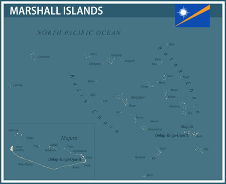
Marshall Islands Map Vector Vintage Dark Blue Beige - Customizable layered political map of Marshall Islands with administrative divisions for website, education, reports, news, politics, print
Коллекция по умолчанию
Коллекция по умолчанию
Создать новую

Vector wireframe mesh polygonal of malta map. Abstract global connection structure. Map connected with lines and dots. Geometric world concept. digital data visualization, infographics.
Коллекция по умолчанию
Коллекция по умолчанию
Создать новую

Kyrgyzstan in red color on simple elegant political globe. 3D illustration
Коллекция по умолчанию
Коллекция по умолчанию
Создать новую

Taiwan Map with Flag Buttons and Assistance & Activates Icons
Коллекция по умолчанию
Коллекция по умолчанию
Создать новую

Guam. Close-up perspective of the country - no outline. topographic relief map
Коллекция по умолчанию
Коллекция по умолчанию
Создать новую

Sunrise above Uruguay highlighted in red on model of planet Earth in space with visible country borders. 3D illustration.
Коллекция по умолчанию
Коллекция по умолчанию
Создать новую

Equatorial Guinea from space on Earth at night. Very fine detail of the plastic planet surface with bright city lights. 3D illustration.
Коллекция по умолчанию
Коллекция по умолчанию
Создать новую
Shape of the Conway Reef tectonic plate on the solid contour map in the Patterson Cylindrical (oblique) projection
Коллекция по умолчанию
Коллекция по умолчанию
Создать новую

Asia map part of a world globe
Коллекция по умолчанию
Коллекция по умолчанию
Создать новую

Shape of the Birds Head tectonic plate on the solid contour map in the Patterson Cylindrical (oblique) projection
Коллекция по умолчанию
Коллекция по умолчанию
Создать новую

Geographical view of Cuba
Коллекция по умолчанию
Коллекция по умолчанию
Создать новую
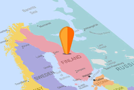
Finland with orange placeholder pin on europe map, close up Finland, vacation and road trip concept, pinned destination, travel idea, top view, colorful map with location icon
Коллекция по умолчанию
Коллекция по умолчанию
Создать новую

Saint Kitts and Nevis Map. Black silhouette country map isolated on white background. Black outline on white background. Vector file
Коллекция по умолчанию
Коллекция по умолчанию
Создать новую
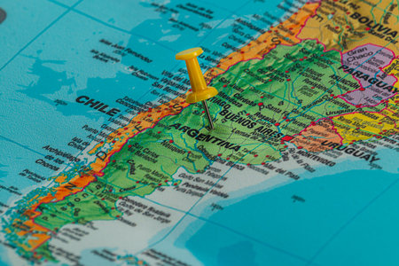
A close view of a map showing Argentina, with a yellow pushpin marking the location of Buenos Aires. The vibrant colors of the map depict surrounding countries.
Коллекция по умолчанию
Коллекция по умолчанию
Создать новую
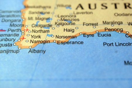
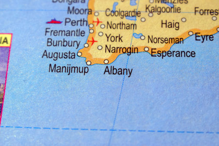
Esperance-Australia Political Map Or Administrative Map With Blurry Background Image
Коллекция по умолчанию
Коллекция по умолчанию
Создать новую

Close up to a Newcastle city with a blue pin needle into Australia country political map
Коллекция по умолчанию
Коллекция по умолчанию
Создать новую

Aerial view of the tropical island in the middle of the Indian Ocean. Maldives
Коллекция по умолчанию
Коллекция по умолчанию
Создать новую
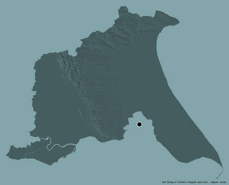
Shape of East Riding of Yorkshire, unitary authority of England, with its capital isolated on a solid color background. Colored elevation map. 3D rendering
Коллекция по умолчанию
Коллекция по умолчанию
Создать новую
Madagascar in red color on globe with watery oceans and shiny metallic landmasses. 3D illustration
Коллекция по умолчанию
Коллекция по умолчанию
Создать новую
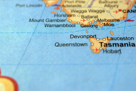
Geelong-Political Map Or Administrative Map Of Australia With Background Blur Image
Коллекция по умолчанию
Коллекция по умолчанию
Создать новую

Lesotho.
Коллекция по умолчанию
Коллекция по умолчанию
Создать новую
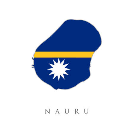
Nauru National Map with flag illustration. Nauru National Map with flag illustration. Nauru country flag inside map contour design icon
Коллекция по умолчанию
Коллекция по умолчанию
Создать новую
Map of Burundi on simple blue political globe. 3D illustration
Коллекция по умолчанию
Коллекция по умолчанию
Создать новую
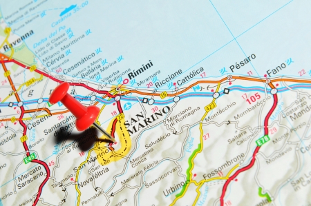
London, UK - 13 June, 2012: San Marino marked with red pushpin on Europe map.
Коллекция по умолчанию
Коллекция по умолчанию
Создать новую

Map of Brunei with a pinned blue pin. Pinned flag of Brunei, vector illustration.
Коллекция по умолчанию
Коллекция по умолчанию
Создать новую

Bioko Sur, province of Equatorial Guinea. Open Street Map. Locations and names of major cities of the region. Corner auxiliary location maps
Коллекция по умолчанию
Коллекция по умолчанию
Создать новую

Flag and map of Palau
Коллекция по умолчанию
Коллекция по умолчанию
Создать новую

Map of Antalya with each administrative district where Finike is pulled out
Коллекция по умолчанию
Коллекция по умолчанию
Создать новую
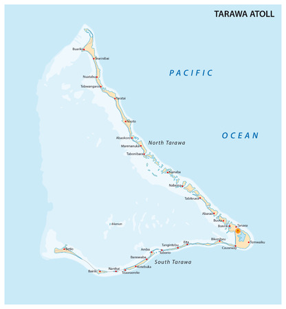
Tarawa Atoll, Kiribati
Коллекция по умолчанию
Коллекция по умолчанию
Создать новую
Weipe-Political Map Or Administrative Map Of Australia With Background Blur Image
Коллекция по умолчанию
Коллекция по умолчанию
Создать новую

gray map of Taiwan
Коллекция по умолчанию
Коллекция по умолчанию
Создать новую

Cuba Map
Коллекция по умолчанию
Коллекция по умолчанию
Создать новую

Liberia on blue digital planet Earth with international network representing communication, travel and connections. 3D illustration.
Коллекция по умолчанию
Коллекция по умолчанию
Создать новую

Isolated south korea map icon
Коллекция по умолчанию
Коллекция по умолчанию
Создать новую

Blue Gambia 3d map with pointer pin surrounded with other countries in white. 3d render illustration
Коллекция по умолчанию
Коллекция по умолчанию
Создать новую
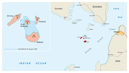
Map of the Indonesian volcano Krakatau Iceland
Коллекция по умолчанию
Коллекция по умолчанию
Создать новую

Hokkaido, circuit of Japan. Elevation map colored in wiki style with lakes and rivers. Locations and names of major cities of the region. Corner auxiliary location maps
Коллекция по умолчанию
Коллекция по умолчанию
Создать новую

Uruguay on globe with realistic blue water and shiny metallic continents. 3D illustration
Коллекция по умолчанию
Коллекция по умолчанию
Создать новую

Map of Timor-Leste. Mosaic style map with flag of Timor-Leste. Curious vector illustration.
Коллекция по умолчанию
Коллекция по умолчанию
Создать новую

Brunei darussalam map vector design template illustration
Коллекция по умолчанию
Коллекция по умолчанию
Создать новую

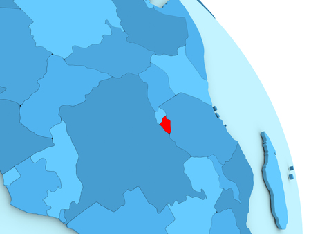
Tanzania on the map close-up. Shallow depth of field.
Коллекция по умолчанию
Коллекция по умолчанию
Создать новую

marshall islands stamp design over stripy background, abstract vector art illustration, image contains transparency
Коллекция по умолчанию
Коллекция по умолчанию
Создать новую

Shape of Aerodrom, municipality of Macedonia, with its capital isolated on white background. Satellite imagery. 3D rendering
Коллекция по умолчанию
Коллекция по умолчанию
Создать новую

Sweden highlighted on a world map. Showing its geographical location, shape and context within Europe. Clear and concise.
Коллекция по умолчанию
Коллекция по умолчанию
Создать новую

An Illustration on an Orange background of Estonia
Коллекция по умолчанию
Коллекция по умолчанию
Создать новую
Map of Bahamas. Low poly illustration of the country. Geometric design with stripes. Technology, internet, network concept. Vector illustration.
Коллекция по умолчанию
Коллекция по умолчанию
Создать новую
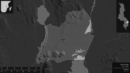
Machinga, district of Malawi. Grayscaled map with lakes and rivers. Shape presented against its country area with informative overlays. 3D rendering
Коллекция по умолчанию
Коллекция по умолчанию
Создать новую
Caribbean highlighted in red on blue political globe. 3D illustration.
Коллекция по умолчанию
Коллекция по умолчанию
Создать новую

Madagascar on model of green planet Earth with international networks. Concept of digital communication and technology. 3D illustration.
Коллекция по умолчанию
Коллекция по умолчанию
Создать новую

Map of New Zealand with embedded national flag. 3D illustration
Коллекция по умолчанию
Коллекция по умолчанию
Создать новую

Коллекция по умолчанию
Коллекция по умолчанию
Создать новую

Close up of Bali and other south pacific islands on a world map
Коллекция по умолчанию
Коллекция по умолчанию
Создать новую
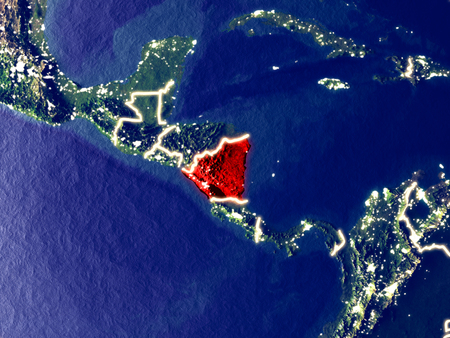
Nicaragua from space on Earth at night. Very fine detail of the plastic planet surface with bright city lights. 3D illustration.
Коллекция по умолчанию
Коллекция по умолчанию
Создать новую
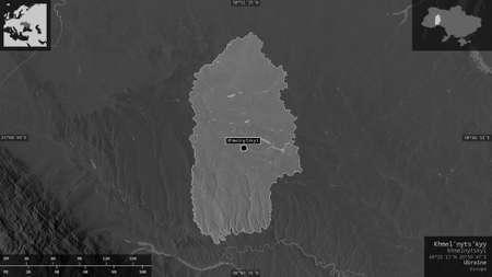
Khmel'nyts'kyy, region of Ukraine. Grayscaled map with lakes and rivers. Shape presented against its country area with informative overlays. 3D rendering
Коллекция по умолчанию
Коллекция по умолчанию
Создать новую

Illustration of French Guiana highlighted in red on grey globe with transparent oceans. 3D illustration.
Коллекция по умолчанию
Коллекция по умолчанию
Создать новую

Dominican Republic, beautiful Caribbean coast with turquoise water and palm trees.
Коллекция по умолчанию
Коллекция по умолчанию
Создать новую

South Georgia and South Sandwich Islands state flag broken material facade structure in big concrete cracked hole
Коллекция по умолчанию
Коллекция по умолчанию
Создать новую

Estonia. Shaded relief map. Surrounding territory greyed out. Colored according to vegetation. Includes clip path for the state area.
Projection: Mercator
Extents: 20.5/29/57/60
Коллекция по умолчанию
Коллекция по умолчанию
Создать новую
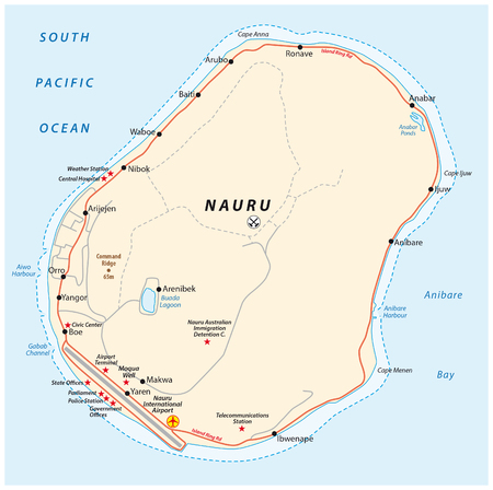
Vector road map of the Republic of Nauru
Коллекция по умолчанию
Коллекция по умолчанию
Создать новую

Woman face painted with flag of Fiji
Коллекция по умолчанию
Коллекция по умолчанию
Создать новую
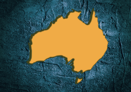
Image relative to Australia travel. Australia map in concrete textured frame
Коллекция по умолчанию
Коллекция по умолчанию
Создать новую
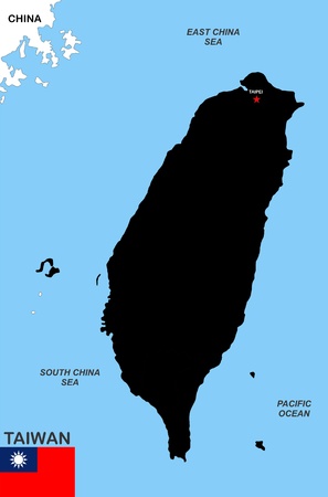
very big size taiwan black map with flag
Коллекция по умолчанию
Коллекция по умолчанию
Создать новую
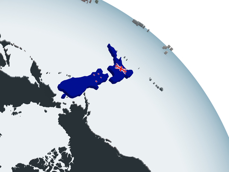
New Zealand on political globe with embedded flag. 3D illustration.
Коллекция по умолчанию
Коллекция по умолчанию
Создать новую
Satellite view of Bahamas highlighted in red on planet Earth with visible country borders during sunset. 3D illustration.
Коллекция по умолчанию
Коллекция по умолчанию
Создать новую

caribbean island
Коллекция по умолчанию
Коллекция по умолчанию
Создать новую
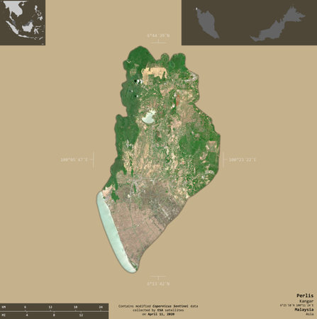
Perlis, state of Malaysia. Sentinel-2 satellite imagery. Shape isolated on solid background with informative overlays. Contains modified Copernicus Sentinel data
Коллекция по умолчанию
Коллекция по умолчанию
Создать новую
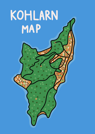
Graphic Adventure Map of Koh Larn Island pattaya Thailand tourism atlas
Коллекция по умолчанию
Коллекция по умолчанию
Создать новую
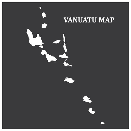
Vanuatu region map illustration symbol design
Коллекция по умолчанию
Коллекция по умолчанию
Создать новую

Ryazan, Russia - July 08, 2018: Country of Republic of the Congo on the google maps service
Коллекция по умолчанию
Коллекция по умолчанию
Создать новую
Abstract Wave Shape Silhouette
Коллекция по умолчанию
Коллекция по умолчанию
Создать новую
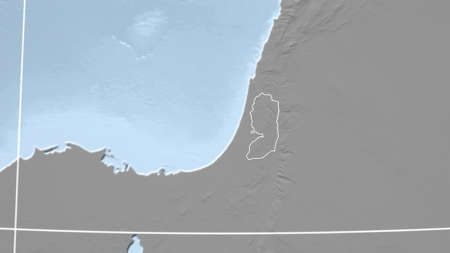
West Bank. Neighborhood - distant perspective with outline of the country. grayscale elevation map
Коллекция по умолчанию
Коллекция по умолчанию
Создать новую

a white hole is in an old paper
Коллекция по умолчанию
Коллекция по умолчанию
Создать новую

Nauru flag with some soft highlights and folds
Коллекция по умолчанию
Коллекция по умолчанию
Создать новую
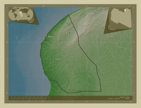
Benghazi, district of Libya. Elevation map colored in wiki style with lakes and rivers. Locations and names of major cities of the region. Corner auxiliary location maps
Коллекция по умолчанию
Коллекция по умолчанию
Создать новую

Liberia during sunset highlighted in red on planet Earth with visible country borders. 3D illustration.
Коллекция по умолчанию
Коллекция по умолчанию
Создать новую

Shape of Margibi, county of Liberia, with its capital isolated on a solid color background. Colored elevation map. 3D rendering
Коллекция по умолчанию
Коллекция по умолчанию
Создать новую

Icon for norway,area
Коллекция по умолчанию
Коллекция по умолчанию
Создать новую
Legion-Media
Создайте свои проекты на основе качественных стоковых фотографий и видео.


Copyright © Legion-Media.