
Savannah city in Georgia. USA cityscape at sunset
Коллекция по умолчанию
Коллекция по умолчанию
Создать новую

An aerial view of the Greensboro, North Carolina skyline
Коллекция по умолчанию
Коллекция по умолчанию
Создать новую

Red tack in a map of Kansas City, Kansas
Коллекция по умолчанию
Коллекция по умолчанию
Создать новую

Aerial view of the city of Vilnius, Lithuania.
Коллекция по умолчанию
Коллекция по умолчанию
Создать новую

Oklahoma state of United States flag textile cloth fabric waving on the top sunrise mist fog
Коллекция по умолчанию
Коллекция по умолчанию
Создать новую

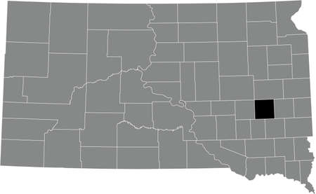
Map of South Dakota
Коллекция по умолчанию
Коллекция по умолчанию
Создать новую

Red clerical needle on a map of the USA, Arizona and the capital Phoenix. Close up map of orizona with red tack, US map pin
Коллекция по умолчанию
Коллекция по умолчанию
Создать новую

Vilnius, Lithuania - July 5, 2016: Sunset Sunrise Dawn Over Cityscape In Evening Summer. Beautiful View Of Modern Office Buildings Skyscrapers In Business District New City Centre Shnipishkes
Коллекция по умолчанию
Коллекция по умолчанию
Создать новую

Drone Aerial of Downtown Spartanburg South Carolina SC Skyline.
Коллекция по умолчанию
Коллекция по умолчанию
Создать новую

Aerial autumn view at church in Chelmno on the Ner River, a village in Poland
Коллекция по умолчанию
Коллекция по умолчанию
Создать новую

Map of Wallace in Kansas
Коллекция по умолчанию
Коллекция по умолчанию
Создать новую

State of Oklahoma. Map of Oklahoma. United States of America Oklahoma. State maps. Vector illustration
Коллекция по умолчанию
Коллекция по умолчанию
Создать новую

Map of Ness in Kansas
Коллекция по умолчанию
Коллекция по умолчанию
Создать новую

06-15-2021 Portsmouth, Hampshire, UK, Okeene Oklahoma USA shown on a Geography map or road map
Коллекция по умолчанию
Коллекция по умолчанию
Создать новую

Newport News, Virginia, USA from above at dusk.
Коллекция по умолчанию
Коллекция по умолчанию
Создать новую

McLaughlin, South Dakota is the largest town on the Standing Rock Native American Reservation
Коллекция по умолчанию
Коллекция по умолчанию
Создать новую

Vilnius, Lithuania, Europe. Sunset Cityscape. Modern Office Buildings Skyscrapers In Business District New City Center Shnipishkes In Night Illuminations
Коллекция по умолчанию
Коллекция по умолчанию
Создать новую

Map of Oklahoma
Коллекция по умолчанию
Коллекция по умолчанию
Создать новую

Aerial landscape of residential area and Atlanta Skyline during fall at sunset in Decatur Atlanta Georgia USA
Коллекция по умолчанию
Коллекция по умолчанию
Создать новую

A high angle shot of a beautiful cityscape in Greenville, South Carolina during sunset
Коллекция по умолчанию
Коллекция по умолчанию
Создать новую

Map of Adair in Oklahoma
Коллекция по умолчанию
Коллекция по умолчанию
Создать новую

Low key picture of a fist painted in colors of american state flag of oklahoma
Коллекция по умолчанию
Коллекция по умолчанию
Создать новую

Top view new development houses with church and subdivision sprawl in background and colorful autumn leaves near Dallas, Texas, America
Коллекция по умолчанию
Коллекция по умолчанию
Создать новую
Oklahoma map on black background
Коллекция по умолчанию
Коллекция по умолчанию
Создать новую

Black highlighted location map of the Craig County inside gray administrative map of the Federal State of Oklahoma, USA
Коллекция по умолчанию
Коллекция по умолчанию
Создать новую

Oklahoma City, Oklahoma on an old torn map from 1949, isolated. Part of the old map series.
Коллекция по умолчанию
Коллекция по умолчанию
Создать новую

Oklahoma map. Poster with map of the us state in retro color palette. Shape of Oklahoma with sunburst rays background. Vector illustration.
Коллекция по умолчанию
Коллекция по умолчанию
Создать новую

Map of Cheyenne in Kansas
Коллекция по умолчанию
Коллекция по умолчанию
Создать новую

Black highlighted location map of the Sequoyah County inside gray administrative map of the Federal State of Oklahoma, USA
Коллекция по умолчанию
Коллекция по умолчанию
Создать новую

Kgalagadi, district of Botswana. Low resolution satellite maps
Коллекция по умолчанию
Коллекция по умолчанию
Создать новую
Expansive aerial view small town layout, featuring houses, roads, surrounding greenery on American small town
Коллекция по умолчанию
Коллекция по умолчанию
Создать новую

Black highlighted location map of the Logan County inside gray administrative map of the Federal State of Oklahoma, USA
Коллекция по умолчанию
Коллекция по умолчанию
Создать новую

Sacramento skyline in California
Коллекция по умолчанию
Коллекция по умолчанию
Создать новую

05-17-2021 Portsmouth, Hampshire, UK, Hastings Minnesota USA shown on a Geography map or road map
Коллекция по умолчанию
Коллекция по умолчанию
Создать новую

McLaughlin, South Dakota is the largest town on the Standing Rock Native American Reservation
Коллекция по умолчанию
Коллекция по умолчанию
Создать новую

mauritania map on a old vintage crack paper background
Коллекция по умолчанию
Коллекция по умолчанию
Создать новую

El Paso, Texas, USA downtown city skyline at dusk with Juarez, Mexico in the distance.
Коллекция по умолчанию
Коллекция по умолчанию
Создать новую

An aerial of a small town in the Saskatchewan province in Canada
Коллекция по умолчанию
Коллекция по умолчанию
Создать новую

Downtown Winston-Salem, NC
Коллекция по умолчанию
Коллекция по умолчанию
Создать новую

Map of Oklahoma
Коллекция по умолчанию
Коллекция по умолчанию
Создать новую

Black highlighted location map of the Tillman County inside gray administrative map of the Federal State of Oklahoma, USA
Коллекция по умолчанию
Коллекция по умолчанию
Создать новую
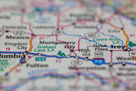
05-18-2021 Portsmouth, Hampshire, UK, Montgomery City Missouri USA shown on a Geography map or road map
Коллекция по умолчанию
Коллекция по умолчанию
Создать новую

Map of Greeley in Kansas
Коллекция по умолчанию
Коллекция по умолчанию
Создать новую

Albuquerque new mexico skyline of downtown
Коллекция по умолчанию
Коллекция по умолчанию
Создать новую

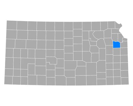
Counties map of Kansas USA
Коллекция по умолчанию
Коллекция по умолчанию
Создать новую

Aerial View of Charleston, South Carolina
Коллекция по умолчанию
Коллекция по умолчанию
Создать новую

WOLFSBERG, AUSTRIA - AUGUST 16 American Football B-EC on August 16, 2009 in Wolfsberg, Austria. Shown is the satdium in Wolfsberg.
Коллекция по умолчанию
Коллекция по умолчанию
Создать новую

Three-dimensional map of Virginia. USA. 3d
Коллекция по умолчанию
Коллекция по умолчанию
Создать новую

San Francisco, California, USA - September 10, 2018: Ocean Quay in the north of San Francisco.
Коллекция по умолчанию
Коллекция по умолчанию
Создать новую

Three-dimensional map of Indiana. USA. 3d
Коллекция по умолчанию
Коллекция по умолчанию
Создать новую

Map of Sequoyah in Oklahoma
Коллекция по умолчанию
Коллекция по умолчанию
Создать новую

The Montana State county map with labels
Коллекция по умолчанию
Коллекция по умолчанию
Создать новую
Black highlighted location map of the Miner County inside gray administrative map of the Federal State of South Dakota, USA
Коллекция по умолчанию
Коллекция по умолчанию
Создать новую

aerial photography of a Russian village in autumn.
Коллекция по умолчанию
Коллекция по умолчанию
Создать новую

Oklahoma FEB 9, 2022 - Close up shot of the sign of OU
Коллекция по умолчанию
Коллекция по умолчанию
Создать новую

Vector illustration map Oklahoma is one of the states of America isolated on a white backgroundŒ
Коллекция по умолчанию
Коллекция по умолчанию
Создать новую

Map of Oklahoma
Коллекция по умолчанию
Коллекция по умолчанию
Создать новую

Red clerical needle on a map of USA, South Alabama and the capital Montgomery. Close up map of South Alabama with red tack, United States map pin USA
Коллекция по умолчанию
Коллекция по умолчанию
Создать новую

Aerial View of the Omaha Suburb of Fremont, Nebraska
Коллекция по умолчанию
Коллекция по умолчанию
Создать новую

Aerial view of a serene golf course nestled in a lush landscape.
Коллекция по умолчанию
Коллекция по умолчанию
Создать новую

Hot Springs NP, AR, USA - September 10, 2022: A well known city for its therapeutic benefits
Коллекция по умолчанию
Коллекция по умолчанию
Создать новую

Shooting in Texas
Коллекция по умолчанию
Коллекция по умолчанию
Создать новую

Aerial cityscape with river and fall foliage in residential Pittsburgh Pennsylvania USA
Коллекция по умолчанию
Коллекция по умолчанию
Создать новую

U.S. states - map of Oklahoma. Hand made. Rivers and lakes are shown. Please look at my other images of cartographic series - they are all very detailed and carefully drawn by hand WITH RIVERS AND LAKES.
Коллекция по умолчанию
Коллекция по умолчанию
Создать новую

Aerial View of Spartanburg, South Carolina at Dusk
Коллекция по умолчанию
Коллекция по умолчанию
Создать новую

Map of Colorado
Коллекция по умолчанию
Коллекция по умолчанию
Создать новую

Aerial View of the Suburb of Belvidere, Illinois
Коллекция по умолчанию
Коллекция по умолчанию
Создать новую

Map of Scott in Kansas
Коллекция по умолчанию
Коллекция по умолчанию
Создать новую

Map of Stevens in Kansas
Коллекция по умолчанию
Коллекция по умолчанию
Создать новую

Sunset Aerial view of Stolipinovo ghetto neighborhood in City of Plovdiv, Bulgaria
Коллекция по умолчанию
Коллекция по умолчанию
Создать новую

Black highlighted location map of the Bryan County inside gray administrative map of the Federal State of Oklahoma, USA
Коллекция по умолчанию
Коллекция по умолчанию
Создать новую

Three-dimensional map of Kansas. USA. 3d
Коллекция по умолчанию
Коллекция по умолчанию
Создать новую

Map of Wallace in Kansas
Коллекция по умолчанию
Коллекция по умолчанию
Создать новую
Gray Map on White Background of Counties of USA Federal State of Montana
Коллекция по умолчанию
Коллекция по умолчанию
Создать новую

Black highlighted location map of the Lehigh County inside gray administrative map of the Federal State of Pennsylvania, USA
Коллекция по умолчанию
Коллекция по умолчанию
Создать новую

Black highlighted location map of the Okfuskee County inside gray administrative map of the Federal State of Oklahoma, USA
Коллекция по умолчанию
Коллекция по умолчанию
Создать новую

Oklahoma on USA map with map of the state
Коллекция по умолчанию
Коллекция по умолчанию
Создать новую
Denver, Colorado, USA downtown cityscape at summer.
Коллекция по умолчанию
Коллекция по умолчанию
Создать новую

Black map of the State of North Dakota - vector illustration. Simple flat map State of North Dakota.
Коллекция по умолчанию
Коллекция по умолчанию
Создать новую

Map of Grand in South Dakota
Коллекция по умолчанию
Коллекция по умолчанию
Создать новую

Two versions of the map of US State Oklahoma, with the flag of Oklahoma and highlighted in dark grey. Vector map.
Коллекция по умолчанию
Коллекция по умолчанию
Создать новую

Map of Harmon in Oklahoma
Коллекция по умолчанию
Коллекция по умолчанию
Создать новую

USA map with the indication of State of Nebraska and Lincoln
Коллекция по умолчанию
Коллекция по умолчанию
Создать новую

Kgalagadi, district of Botswana. Low resolution satellite map
Коллекция по умолчанию
Коллекция по умолчанию
Создать новую

October 7th, 2015 - Montreal, Canada. Old 1940s Webster's Dictionary United States of America Map Close-up
Коллекция по умолчанию
Коллекция по умолчанию
Создать новую

Aerial view of Boulder City during summer season, Colorado, USA
Коллекция по умолчанию
Коллекция по умолчанию
Создать новую

Map of Colorado
Коллекция по умолчанию
Коллекция по умолчанию
Создать новую

Map of Gray in Kansas
Коллекция по умолчанию
Коллекция по умолчанию
Создать новую
Map of Douglas in Kansas
Коллекция по умолчанию
Коллекция по умолчанию
Создать новую
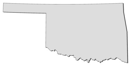
Map of Oklahoma, a state of United States.
Коллекция по умолчанию
Коллекция по умолчанию
Создать новую

South Dakota state map with long shadow
Коллекция по умолчанию
Коллекция по умолчанию
Создать новую

A Map of the the United States of America with 1 state selected - Oklahoma
Коллекция по умолчанию
Коллекция по умолчанию
Создать новую

Nuristan, province of Afghanistan. Open Street Map. Locations and names of major cities of the region. Corner auxiliary location maps
Коллекция по умолчанию
Коллекция по умолчанию
Создать новую

Boise, Idaho, USA downtown cityscape at twilight.
Коллекция по умолчанию
Коллекция по умолчанию
Создать новую

Map of Doniphan in Kansas
Коллекция по умолчанию
Коллекция по умолчанию
Создать новую

05-17-2021 Portsmouth, Hampshire, UK, Cannon Falls Minnesota USA shown on a Geography map or road map
Коллекция по умолчанию
Коллекция по умолчанию
Создать новую

Map of Lincoln in South Dakota
Коллекция по умолчанию
Коллекция по умолчанию
Создать новую

Black highlighted location map of the Stillwater County inside gray map of the Federal State of Montana, USA
Коллекция по умолчанию
Коллекция по умолчанию
Создать новую

United States with selected Oklahoma map and Oklahoma flag icon. Vector map and flag.
Коллекция по умолчанию
Коллекция по умолчанию
Создать новую

Aerial view of the Boulder cityscape at Colorado
Коллекция по умолчанию
Коллекция по умолчанию
Создать новую
Legion-Media
Создайте свои проекты на основе качественных стоковых фотографий и видео.


Copyright © Legion-Media.